The circuit follows the Marsyangdi to Manang and Thorong La, then drops to Muktinath and Jomsom. Pisang, Braga, and the pass morning are the walking days. The Marsyangdi climb, Thorong La, and Muktinath are the spine of this circuit.
Shared buses cover the road sectors. You still need proper boots and a sleeping bag for the lodge nights on the hill. A night at Thorong Phedi or High Camp sits before the pass morning, with apple-country lodges on the Kali Gandaki descent.
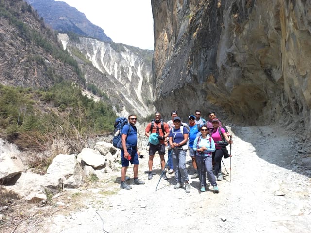
Guides licensed through MOCTCA and NATHM, and trained on altitude illness, pace the Marsyangdi from Jagat through Dharapani, Chame, and Pisang so Manang is a real rest before Thorong La. You'll cross at 5,416 m with an early start from Thorong Phedi, then descend to the Muktinath courtyard rather than rushing the col in the afternoon wind.
We'll book the Kathmandu to Besisahar bus, the shared jeep to Jagat, and the Jomsom to Pokhara bus from the same desk, with ACAP and TIMS already in hand. Your guide shares the next teahouse night every evening, and we would rather add the Gangapurna lake walk than stack the pass without that Manang buffer.
You arrive at Kathmandu and take a scenic drivefrom Kathmandu to Besisahar (760 m / 2,493 ft), a distance of approximately 140 km in 5-6 hours. The highway goes through the green hills, rivers, and traditional villages. Along the way, you will follow the Marsyangdi River, which guides much of your trekking route.
Once in Besisahar, visit the bustling trade town, full of shops, cafes, and guesthouses. Here, your guide will make permit arrangements. It is the last town where a person can find convenient facilities and head further into the mountains.
Take a hot meal and get ready for the trek. Get yourself a good sleep, and you will wake up fresh the day after.
Today begins with a jeep drive, starting at Besisahar and heading to Jagat (1,300 m / 4,265 ft) over a rough mountain track, which takes approximately 3-4 hours. From Jagat, your trek officially begins. The trail goes through a river and up through pine and oak forests.
You go through tiny villages such as Chamje (1,410 m / 4,626 ft), Tal (1,700 m / 5,577 ft), where one can take a break and enjoy a simple environment. The trail goes through the shifting terrain to Dharapani (1,860 m / 6,102 ft). This village is also a key checkpoint, as well as providing simple lodges which serve hot meals and mountain views.
Rest in a quiet atmosphere after a tiring day of walking and traveling.
The path is now ascended continuously out of Dharapani (1,860 m / 6,102 ft) into the deep pine-forests. You pass little villages and breathe fresh mountain air. There is a monastery at Timang (2575 m, 8448 ft) and, on a clear day, you can see a beautiful view of Annapurna II.
This road passes through forested hilly territory to Chame (2,670 m / 8,760 ft), the headquarters of the Manang district. Chame is better equipped with lodges and a monastery. The village has a pleasant and welcoming environment.
Upon arrival, you will be able to relax, have a hot meal, and admire the mountainous landscape with the help of a setting sun behind the mountains.
The trail leaves Chame (2,670 m / 8,760 ft) and enters the drier and higher area of Manang. The topography is more open and rockier. You go through Bratang (3,090 m / 10,138 ft) and DhukurPokhari (3,200 m / 10,499 ft), and the scenery can be seen expanding.
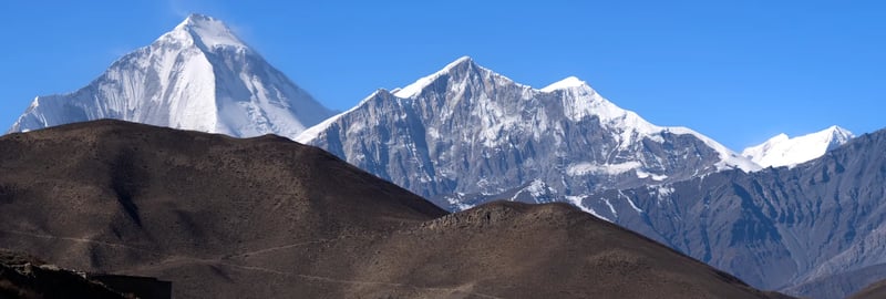
Then, on your trek, you get to Pisang, and then there is Upper Pisang (3,300 m / 10,827 ft). The town of Upper Pisang is located on a cliff and is a beautiful sight of Annapurna II and LamjungHimal, as well as Pisang Peak. An ancient monastery is also worth a visit.
Below it is Lower Pisang that has traditional houses and fields. Stay overnight in a mountain lodge and take in the scenic views.
The journey passes through the desert terrain at a high altitude. You pass through Ghyaru (3,550 m / 11,647 ft), where prayer wheels and mountain sceneries offer a serene environment. This path then continues to Ngawal (3,550 m / 11,647 ft), a small village with a monastery.
Here, the road passes through fields and open country to Manang (3,520 m / 11,549 ft). The biggest village of the area is Manang and has numerous teahouses, shops, and bakeries. The valley is very wide, which offers beautiful scenery of the mountains around.
It is a major acclimatization point, and time should be taken to have a rest and adapt to the altitude.
It is a significant rest and acclimatization day in Manang (3,520 m / 11,549 ft). You may go sightseeing around the village, go to a monastery, or just have a rest in one of the cafes.
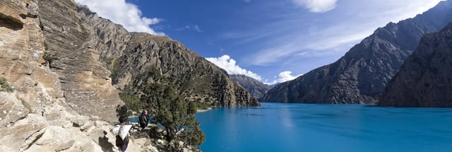
In a short time, one can walk to the Gangapurna Lake (3,540 m / 11,614 ft), which is approximately a 3-4 hour round trip. The lake is very beautiful with mountain reflections, and it makes your body acclimate to the increased altitude.
Take the remaining day off and relax, taking warm liquids and spending time in the peaceful environment. Relaxing now will get you ready for the greater heights in the future.
The trail leaves Manang (3,520 m / 11,549 ft) and ascends to higher regions of the mountains. You are passing through open pastures and rocky paths, and the air thins. A 3-4-hour walk brings you to Yak Kharka (4,020 m / 13,189 ft).
This is the place where locals keep yaks, and there are some primitive lodges. The landscape is isolated and drierwithfewer trees and more scratches. The temperature declines here, particularly during the nights.
Once there, sleep and make your body ready to climb higher.
Today there is a shorter distance to walk, but a more difficult one, because you will be climbing to ThorongPhedi (4,200 m / 13,780 ft). The trail goes through the rocky terrain, and it slowly rises in height. You will be walking at a slow pace of about 3-4 hours in order to get used to the altitude.
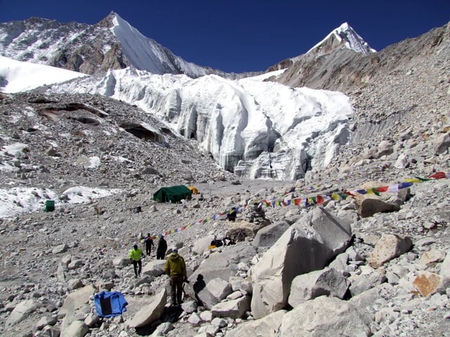
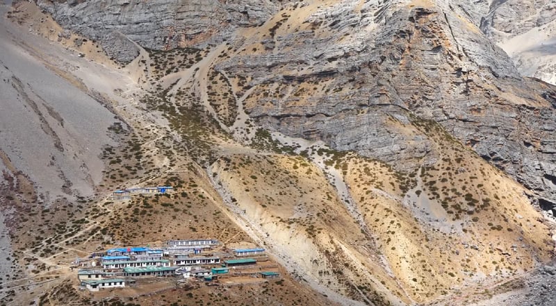
ThorongPhedi is a little village containing a few lodges at the foot of the pass. Upon arrival, rest and eat an early dinner. You will begin very early the following morning to cross the high pass.
Good sleep is needed to face such a tough day.
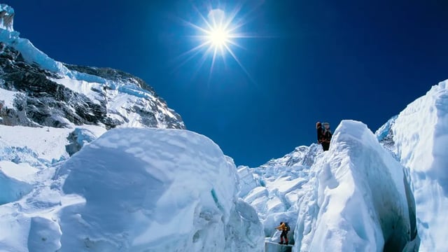
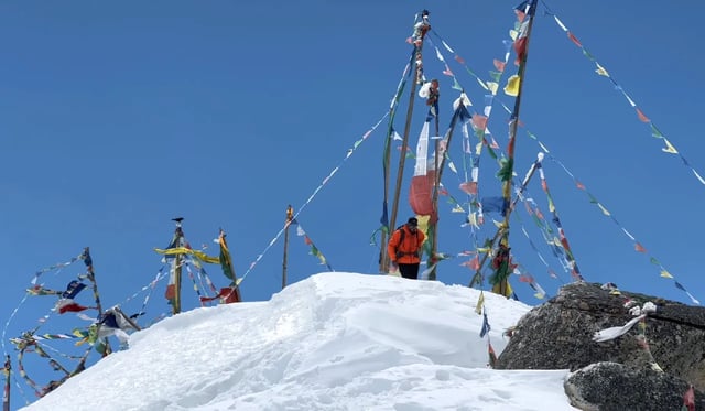
This is the most difficult and the most rewarding day of the trek. You begin early and reach Thorong La Pass (5,416 m 17,769 ft), which is the highest point of the trek. The sharp climb is approximately 3-4 hours.
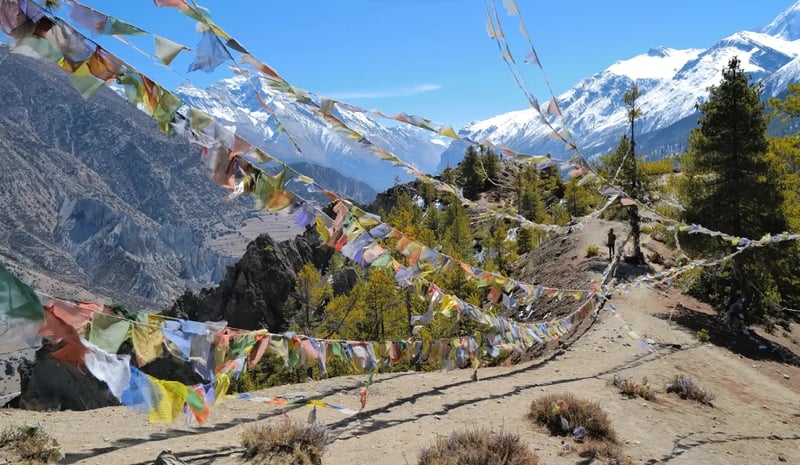
It is rewarded at the top with expansive Himalayan scenes, as well as colorful prayer flags. Going through the pass, you go down to Muktinath (3,760 m / 12,336 ft). The descent is very long, and it requires several hours to traverse rocky paths.
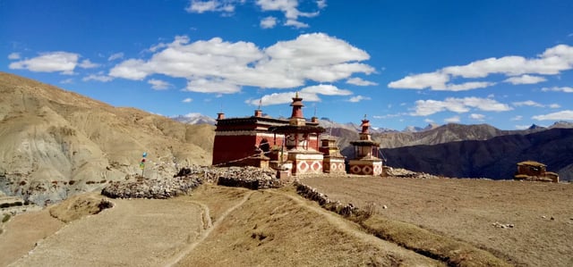
Mukhinath is a holy site, which possesses a temple and 108 water spouts. Having had a hard day, sleep and enjoy the silent spiritual environment.
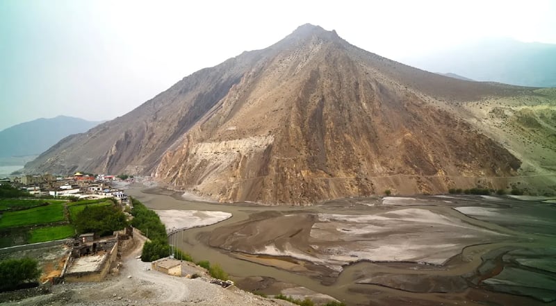
You drive fromMuktinath (3,760 m / 12,336 ft) to Pokhara (822 m / 2,697 ft) on this day. The trip takes the Kali Gandaki River across the deep valleys and villages such as Kagbeni and Jomsom.
You may pass by Marpha of apples, and go through Beni. The scenery slowly transforms into green hills as opposed to arid mountains.
You arrive at Pokhara, a lovely lake city, after approximately 6-7 hours and a 176 km drive. And, this is the end of the Annapurna Circuit Budget Trek.
Most guests fly into Tribhuvan International Airport in Kathmandu. Share your arrival time ahead of travel so a Thamel hotel transfer can be arranged, or make your own way to the meeting hotel.
Many departures include a road transfer to Pokhara before walking starts from Nayapul or a nearby trailhead. Allow a little extra time after the trek before international flights home.
Twin or double rooms in a comfortable Kathmandu hotel cover your first nights and your return from the trail, with breakfast on those city stays when included in the package. Briefings happen at the hotel, and airport collection from Tribhuvan is available when flight times are shared in advance.
Family-run teahouses or lodges line the route with twin beds and a shared dining room. Rooms get simpler and colder as you climb, with shared bathrooms common at higher villages. Hot water, Wi-Fi, and charging are paid at the lodge when offered.
March to May rhododendron bloom and October to November crisp air are peak windows for this itinerary. July and August mean leeches and cloud on lower slopes; December to February can ice steps above village level.
Your guide reads the forecast before long cols or sunrise hikes. Shoulder weeks need an honest weather call before high passes or dawn viewpoints.
You should be comfortable walking several hours a day on uneven paths with a daypack, including steady uphill sections as you gain height. Hill training and longer weekend walks in the months before travel help your legs and lungs on uphill trail days.
Hill training, stair climbing, and longer weekend hikes in the months before travel help your legs and lungs, even when acclimatisation days are built into the route. Break in boots before you fly and carry a light daypack on practice walks.
Guided trekking with licensed leaders, lodge nights on the trail, meals as described for walking days, and permits for the regions crossed are included when they are part of this trip. Domestic flights, porters, and airport transfers apply only when they are part of this trip.
Domestic flights, road transfers, porter support, and airport transfers apply only when they are part of this trip. Permits for the regions you cross are arranged in Kathmandu or Pokhara when included.
International flights to Nepal, visa fees, compulsory travel insurance, personal trekking clothing, snacks and drinks outside included meals, and tips for crew are not covered. Hot showers, Wi-Fi, and battery charging in lodges are usually paid locally when offered.
Charges for hot showers, Wi-Fi, or battery charging in lodges are paid locally when offered unless your trip notes say otherwise. International flights, visa fees, and personal insurance stay outside the trek package.
Airport collection to your Kathmandu hotel is available when flight times are shared in advance. Thamel hotels are the usual meet point; drivers need flight numbers to meet you at the international terminal.
Pokhara hotel meet applies when your package starts lakeside; allow a full day for the drive from the capital if that sector is included. Allow a little extra time after the trek before international flights home in case mountain roads or flights move.
Guides set a steady pace and watch for headache, nausea, or dizziness as you gain height. Weather can shift daily plans, so your guide keeps a steady pace with regular breaks.
Tell your guide early if symptoms appear so tomorrow's stage can shorten or descent can start before conditions worsen. Trail conditions are checked each morning before the group moves.
Road transfer from Kathmandu to Pokhara and a short drive to Nayapul or another start point are common when transport is included. Your guide confirms departure times at briefing.
Motion sickness medicine helps on winding mountain roads. Your crew would rather wait for a safe window than rush marginal weather.
Annapurna Conservation Area Permit and TIMS registration apply on this route. The team arranges paperwork in Kathmandu or Pokhara when you provide passport copies and trek dates.
Keep copies in your daypack for checkpoint stops. Monsoon cloud sits lower on the hills while winter brings ice on steps above village level.
Families join when children can manage the daily hours and terrain on this specific route. Pace and daily hours can be adjusted on private departures, though that may extend the calendar.
Ask our Kathmandu team if you are planning with younger walkers. Private departures can shorten daily hours, though that may add a day or two to the calendar.
Comprehensive travel insurance that covers trekking to the highest altitude on your itinerary, medical evacuation, and helicopter rescue when applicable is essential. Many standard policies exclude high altitude by name.
Read the wording before you travel so you can adjust cover if trekking above 5,000 metres is not named. Many standard policies exclude high altitude by name, so read the wording before you fly.
We partner with Rewilding Britain to help protect our natural spaces for future adventures.
All centres are vetted for safety and quality. Your adventure is in good hands with adventuro.
About the centre
Kathmandu
You'll travel with a Kathmandu-based team that plans treks, peak climbs, helicopter flights, motorbike journeys, and cultural trips across Nepal, Tibet, and Bhutan. Routes range from classic teahouse walks and high passes to luxury lodge itineraries and longer expedition-style climbs, with departures shaped around how you want to pace the mountains.
Licensed guides and office staff train regularly on mountain safety and guest care. Porters are insured, fairly paid, and equipped for the trail, with sensible load limits on lodge routes. We work with remote communities through sustainable tourism, including support for education in village areas, so your booking helps local people as well as your own adventure.
Operated by Himalayan Adventure Treks & Tours, a partner of adventuro.