We partner with Rewilding Britain to help protect our natural spaces for future adventures.
All centres are vetted for safety and quality. Your adventure is in good hands with adventuro.
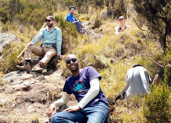
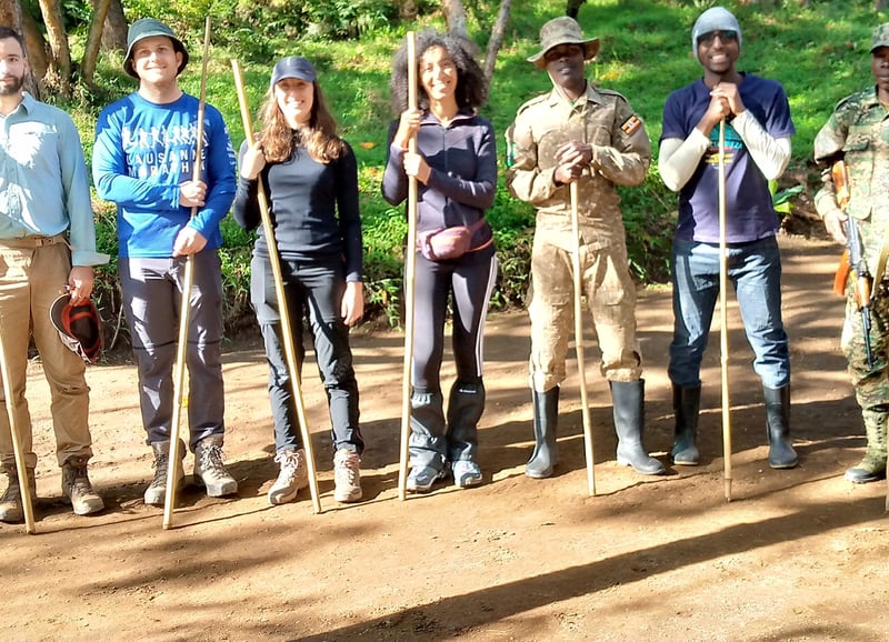
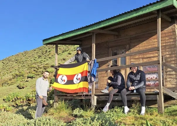
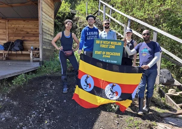
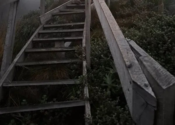
Escala uno de los volcanes de Virunga en una caminata guiada y estructurada de dos días desde Kisoro. Esta experiencia combina un ascenso constante, acampada a gran altitud y un intento de alcanzar la cumbre, con amplias vistas de Uganda, Ruanda y la República Democrática del Congo. Diseñada para senderistas motivados, ofrece una progresión clara desde la base hasta la cumbre, con orientación profesional durante todo el recorrido.
Esta caminata de montaña de dos días sigue un ascenso estructurado hasta un campamento de altura, antes de intentar alcanzar la cumbre el Día 2. El ritmo es constante, con paradas de descanso programadas para gestionar la altitud y el terreno. Espera una subida prolongada, zonas de vegetación cambiantes y condiciones más frescas a medida que ganes altura.
La ruta avanza desde tierras de cultivo y bosque hasta terreno alpino. El Día 1 se centra en un ascenso controlado y la aclimatación, mientras que el Día 2 incluye la subida a la cumbre, seguida de un descenso completo hasta la base. Los guías controlan el ritmo, la seguridad y los intervalos de descanso durante todo el recorrido.
El monte Muhavura forma parte de la cordillera volcánica de Virunga, en el suroeste de Uganda, cerca de las fronteras con Ruanda y la República Democrática del Congo. La región se caracteriza por sus empinadas laderas volcánicas, vegetación de gran altitud y crestas despejadas que ofrecen vistas panorámicas.
Kisoro es la localidad de acceso a la montaña, con entrada por Mutanda Road. Su proximidad al lago Mutanda y al Parque Nacional Impenetrable de Bwindi la convierte en una base estratégica para experiencias de montaña y vida silvestre.
Esta caminata es adecuada para personas con buena condición física y experiencia previa en senderismo. Aunque no se requiere escalada técnica, debes poder caminar cuesta arriba durante varias horas a gran altitud.
Los participantes deben sentirse cómodos caminando en condiciones frescas y de gran altitud, así como descendiendo por terrenos empinados. La resistencia cardiovascular y una buena estabilidad de las piernas son importantes tanto para el ascenso como para el descenso.
Cada caminata de varios días se planifica cuidadosamente, con un ritmo estructurado, sesiones informativas de seguridad y guías locales profesionales que conocen el terreno de la montaña y sus patrones meteorológicos. Las rutas se organizan para equilibrar el desafío con una progresión alcanzable, ofreciendo a los senderistas las mejores posibilidades de llegar a la cumbre de forma segura.
El enfoque general promueve el turismo responsable, el apoyo a las comunidades locales y el cuidado del medioambiente en áreas protegidas. La logística, los permisos y la coordinación se gestionan con antelación, para que puedas concentrarte por completo en la ascensión.
Te reunirás en Mutanda Road, en Kisoro, a las 6:30 am para una sesión informativa y una revisión del equipo antes de dirigirte a la entrada del parque. Tras el registro y una última sesión informativa de seguridad, comienza la caminata. El sendero asciende gradualmente por las estribaciones cultivadas hasta el bosque montano, con varias pausas para regular la respiración y la hidratación.
A medida que aumenta la altitud, la vegetación se vuelve más escasa y las vistas se amplían sobre la cordillera de Virunga. A primera hora de la tarde llegarás al campamento designado. Aquí tomarás el almuerzo para llevar, seguido de un descanso y de la preparación para el intento de alcanzar la cumbre del día siguiente. Las temperaturas descienden considerablemente con la altitud, por lo que es esencial vestirse con varias capas.
El despertar es a las 6:00 am para comenzar temprano antes de dirigirte hacia la cumbre. La subida es más empinada y expuesta, por lo que requiere pisar con cuidado y mantener un ritmo constante. Llegar a la cumbre te recompensará con amplias vistas de tres países y del área del cráter.
Después de pasar un tiempo en la cima para hacer fotografías y recuperarte, descenderás al campamento para desayunar antes de continuar hasta la base de la montaña. El descenso completo requiere movimientos controlados para proteger las rodillas y los tobillos. Al regresar, recibirás un certificado que acredita haber alcanzado la cumbre.
Esta es una caminata exigente a gran altitud y no debe considerarse fácil a pesar del ritmo estructurado. La cumbre se encuentra aproximadamente a 4,127 metros, y el ascenso implica una subida constante por un terreno escarpado.
No necesitas conocimientos de escalada técnica, pero se recomienda encarecidamente tener una buena condición cardiovascular y experiencia previa en senderismo. La altitud puede hacer que la subida resulte más exigente que las caminatas a menor elevación.
La experiencia previa en alta montaña es beneficiosa, pero no obligatoria. Sin embargo, debes estar preparado para temperaturas más frescas, aire más escaso y un ascenso constante durante dos días.
Si nunca has hecho senderismo por encima de los 3,000 metros, es aconsejable evaluar cuidadosamente tu estado físico y consultar cualquier condición médica antes de reservar.
Los permisos del parque suelen ser independientes del paquete básico, salvo que se confirme lo contrario en el momento de la reserva. Las tarifas de los permisos pueden variar según la nacionalidad y la normativa vigente del parque.
Es importante confirmar con antelación el coste actual del permiso para poder calcular correctamente el presupuesto de toda la experiencia.
Te alojarás en un campamento designado en la montaña. Las condiciones son básicas y están expuestas al clima de gran altitud, por lo que es importante prepararse.
Un saco de dormir adecuado, una esterilla aislante y ropa en capas son esenciales para pasar la noche cómodamente, ya que las temperaturas pueden bajar considerablemente después del atardecer.
Los servicios de porteadores suelen estar disponibles por un suplemento y pueden ayudar a transportar equipo pesado, como material de acampada y agua adicional.
Contratar un porteador es recomendable si prefieres caminar con una mochila ligera, especialmente en el tramo de cumbre, donde es importante conservar la energía.
Las comidas no están incluidas automáticamente, salvo que se confirmen durante la reserva. Algunos senderistas organizan por separado y con antelación los almuerzos para llevar y el desayuno.
Es aconsejable llevar tentempiés ricos en energía y suficiente agua, ya que las necesidades calóricas aumentan con la altitud y el esfuerzo prolongado.
Los meses más secos suelen ofrecer condiciones más estables en el sendero y vistas más despejadas de la cumbre. Sin embargo, el tiempo en la montaña puede cambiar rápidamente en cualquier época del año.
Se recomienda consultar los patrones de lluvia estacionales antes de reservar, ya que las condiciones húmedas pueden hacer que los senderos sean resbaladizos y aumentar la dificultad.
Como la cumbre supera los 4,000 metros, pueden aparecer síntomas relacionados con la altitud. El formato estructurado de dos días ayuda a regular el ritmo, pero no elimina el riesgo.
Mantenerse hidratado, ascender de forma constante e informar inmediatamente al guía si te encuentras mal son medidas de seguridad esenciales.
Las botas de senderismo resistentes, con buen soporte para los tobillos y una suela con buen agarre, son esenciales. El sendero incluye tramos empinados y terreno volcánico irregular.
Las zapatillas ligeras o el calzado informal no son adecuados para esta caminata debido a la pendiente y a las condiciones variables del terreno.
El tiempo en la montaña puede cambiar rápidamente, especialmente a mayor altitud. Los guías evalúan continuamente las condiciones de seguridad durante la caminata.
Si el tiempo supone un riesgo para la seguridad, los intentos de alcanzar la cumbre pueden retrasarse o modificarse. Las decisiones de seguridad siempre tienen prioridad sobre completar la ascensión.

Sobre el centro
Kisoro, UG
Operado por Santaviva Ltd, un partner de adventuro.

Central & Atlas Mountains, Morocco
Desde $400
Upper Norrland (Övre Norrland), Sweden
Desde £760