We partner with Rewilding Britain to help protect our natural spaces for future adventures.
All centres are vetted for safety and quality. Your adventure is in good hands with adventuro.
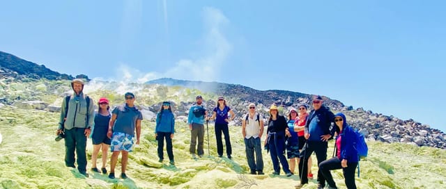
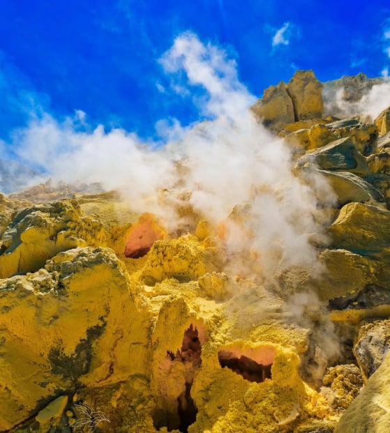
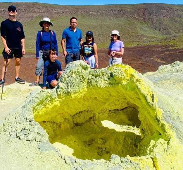
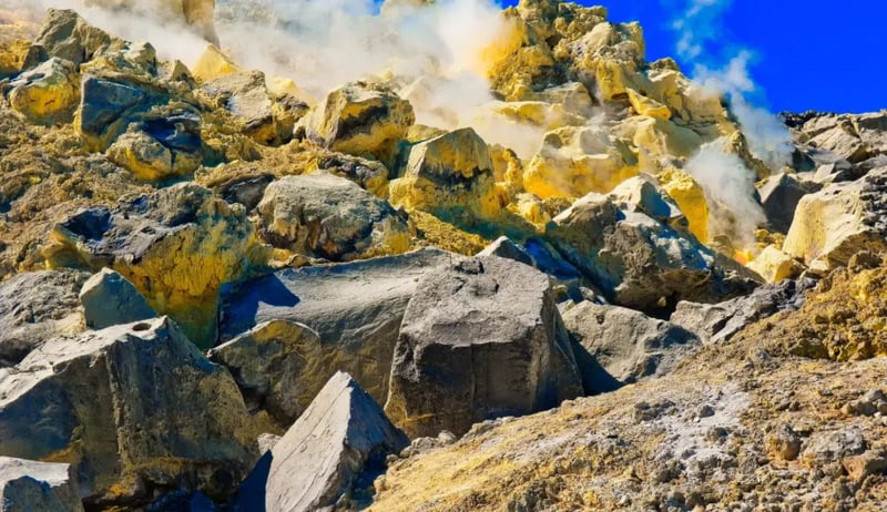
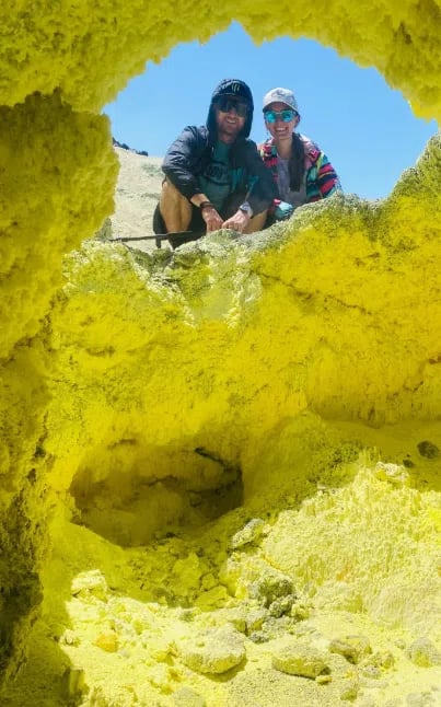
Venture across Isabela’s volcanic highlands to witness the Sulfur Mines up close. The hike passes steaming fumaroles, colorful mineral deposits, and rugged terrain shaped by ongoing geothermal activity. Along the way, you’ll see how life adapts to extreme volcanic conditions and gain insight into the forces that shaped the Galápagos Islands.
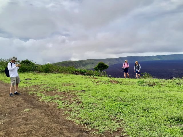
A short transfer from Puerto Villamil brings you to the trailhead at El Cura station. Along the route, enjoy sweeping views of volcanic ridges and highland landscapes. Your guide will outline the trail, highlight safety points, and explain the day’s plan, including the areas where geothermal activity is most intense.
The trail moves from lush highlands into mineral-rich volcanic fields. Along the way, you’ll pass endemic plants and observe wildlife adapted to this unique environment. Approaching the Sulfur Mines, the air grows warm and sulfur-scented, while fumaroles release steam and gas from beneath the earth. Guides explain the geological and chemical processes behind these phenomena and share how organisms survive in these conditions.
At the Sulfur Mines, take time to explore and photograph the vivid yellow, red, and orange deposits. A picnic lunch allows a pause amid the dramatic scenery. On the return hike, notice how the landscape shifts back to green highlands, giving perspective on the stark contrasts of Isabela’s volcanic ecosystem. Guides will discuss the island’s ongoing geological activity and its effect on both landscape and wildlife.
The Sulfur Mines are situated in the highlands of Isabela Island, roughly 5 km from Puerto Villamil. This area is characterised by geothermal features such as fumaroles and mineral-rich soil that create striking yellow, red, and orange hues across the terrain.
Highland vegetation surrounds parts of the trail, offering habitat for endemic plants and bird species. The open volcanic fields provide panoramic views across the island and the Pacific, illustrating the dramatic interplay between ecology and active geology on Isabela.
Hikers should be in moderate physical condition and comfortable walking on uneven volcanic terrain. The round-trip hike covers about 10 km (6.2 miles) and includes steep and rough sections, so sturdy footwear, sufficient water, and sun protection are essential. Individuals with respiratory or heart issues should avoid fumarole areas due to sulfur fumes.
Previous hiking experience is useful but not mandatory. Guides maintain a manageable pace, with rest stops for observation, photos, and discussion of volcanic features. Layered clothing is advised to adapt to variable temperatures between shaded highlands and exposed volcanic surfaces.
Local guides have extensive knowledge of Isabela’s volcanic landscapes, geothermal processes, and endemic species. Their explanations of geology and ecology make each section of the hike informative and engaging.
Small groups ensure personalised attention, safer navigation of rough terrain, and opportunities to ask questions or take photos at key viewpoints. A focus on responsible tourism ensures a meaningful experience that highlights conservation and environmental awareness.
The trail covers about 10 km (6.2 miles) through volcanic terrain that is uneven, rocky, and occasionally steep. While moderate in rating, careful footing is important in certain sections, especially near fumaroles and loose gravel.
The guide maintains a steady pace, allowing breaks for rest, photography, and observation of geothermal activity. Hikers who pace themselves and follow instructions can complete the route comfortably.
Hiking boots or sturdy closed-toe shoes are essential for volcanic surfaces. Breathable, layered clothing is ideal to adapt to shaded and exposed sections of the trail.
Bring sunscreen, a hat, sunglasses, water, camera, and a small backpack. Masks are recommended in areas with strong sulfur fumes, and carrying walking poles can assist on uneven sections.
Yes, anyone aged 14 and above can take part. Teens able to walk moderate distances over uneven terrain will find the hike enjoyable and educational.
The guide points out volcanic formations, endemic plants, and wildlife, making it engaging for younger hikers and helping them understand the island’s geology and ecology.
Highland sections support endemic birds, plants, and small reptiles. The Sulfur Mines themselves have fewer species, but hardy plants and adapted animals are still visible.
Observant hikers may spot birds along the trail and unique plants that survive in mineral-rich volcanic soils. These contrasts highlight the resilience of life in extreme conditions.
Yes, a boxed lunch is provided near the Sulfur Mines. The picnic area offers space to rest, enjoy views, and discuss the geology of the region with the guide.
It’s recommended to bring extra water, as the volcanic terrain can be warm and physically demanding.
The full hike, including rest stops, lunch, and photo opportunities, lasts approximately 5 hours.
Guides keep a pace suitable for most walkers, adjusting as needed for terrain or group preferences while ensuring the schedule remains on track.
Yes, with caution. The guide marks areas with higher geothermal activity. Masks can reduce exposure to sulfur fumes, and it’s important to avoid lingering directly above vents.
Individuals with respiratory or heart conditions should avoid the hottest fumarole zones. Staying on the marked paths ensures safety while still providing close observation of these dramatic natural features.
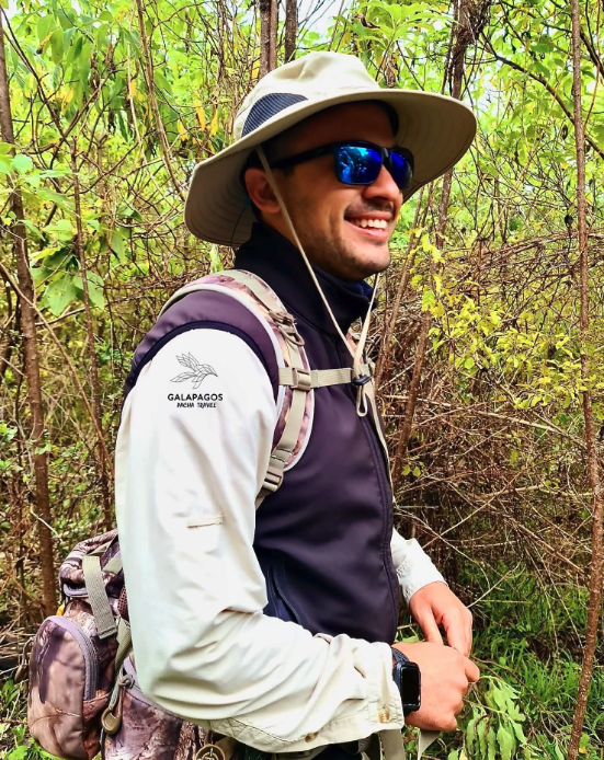
About the centre
Puerto Villamil
Operated by Galapagos Pacha Travel, a partner of adventuro.

Quito & Avenue of Volcanoes, Ecuador
From £118.90

Western Volcanoes, Ecuador
From $411