

Top Paragliding Apps You Don’t Want To Fly Without
Paragliding offers an exhilarating sense of adventure and freedom in the skies. To make the most of this experience, the right apps can take your flying to new heights. From tracking weather conditions to finding the best launch sites, mobile apps have become essential tools for modern paragliders.
And while there are popular options, we’ll also introduce you to some lesser-known, but equally powerful, paragliding apps.
We’ve researched, reviewed, and compiled a comprehensive guide to the top paragliding apps to help you prepare for your next airborne journey. With insights from our experienced paraglider and highlights from user reviews, you’ll discover apps that enhance your flight, prioritize safety, and ensure compliance with legal regulations.
Please note that app access, prices and trial offers can change and may vary from country to country.
Top Paragliding Apps By Category
We’ve categorized the top paragliding apps by their primary functions to help you find the perfect tools that match your flying style. Sure, some apps might shine in multiple areas (they’re just that good!), but we’ve sorted them based on their main focus and top performance in each category.
- Flight Tracking & Logging Apps
- Flyskyhy Soaring App
- XCTrack
- TheFlightVario
- Gaggle Flight Recorder App
- FlyMe
- Paragliding Tracker: Wingman
- xC Analytics
- Wingit
- Paragliding Navigation & Mapping Apps
- FlySafe
- SeeYou Navigator App
- XCSoar
- Air Navigation Pro
- Paragliding Map
- Hike and Fly Paragliding Apps
- onX Maps
- MapOut
- AllTrails
- PeakFinder
- Gaia GPS
- Thermal & Lift Optimization Tools
- Paraglidable
- XC Therm
- Weather & Wind Forecasting Apps
- Windy.app
- Meteoblue
- Paragliding Community & Competition Apps
- XContest XCTrack
- WeGlide
- Air Tribune
- Paragliding Safety & Emergency Assistance Apps
- MySOS
- Life360
- Cairn
- Red Cross First Aid App
- Communication
- FANET
- Paragliding Apps FAQs
- Tips for Paragliding App Combinations
- Happy Soaring!
Table Summary, Comparison & Overview of Top Paragliding Apps
| App Name | Main Category | Other Categories | Free Version Available | User Rating | Best For | Key Features | Flight Phase |
|---|---|---|---|---|---|---|---|
| Flyskyhy Soaring App | Flight Tracking & Logging | Thermal & Lift Optimization, Navigation & Mapping | No | ★★★★☆ (4.5/5) | All Skill Levels | Real-time flight data, airspace warnings, thermal assistance, customizable interface, external variometer integration | All Phases |
| XCTrack | Flight Tracking & Logging | Thermal Optimization, Navigation & Mapping, Community & Competitions, Weather & Wind Forecasting | Yes | ★★★★☆ (4.6/5) | Advanced Pilots | Real-time flight data, thermal optimization, competition tools, customizable dashboards, offline maps | All Phases |
| TheFlightVario | Flight Tracking & Logging | Thermal & Lift Optimization, Navigation & Mapping, Weather & Wind Forecasting | Yes | ★★★★☆ (4.4/5) | Beginners | Real-time flight data, customizable interface, flight logging | During-Flight, Post-Flight |
| Gaggle Flight Recorder App | Flight Tracking & Logging | Community & Competitions, Navigation & Mapping, Weather & Wind Forecasting | Yes | ★★★★★ (4.9/5) | Competitive Pilots | GPS flight tracking, IGC export, flight playback, real-time tracking | All Phases |
| FlyMe | Flight Tracking & Logging | Navigation & Mapping, Thermal & Lift Optimization | Yes | ★★★★★ (4.8/5) | All Skill Levels | Real-time flight data, offline maps, thermal tracking, airspace alerts | All Phases |
| Paragliding Tracker: Wingman | Flight Tracking & Logging | Community & Competitions, Navigation & Mapping | Yes | ★★★★☆ (4.7/5) | All Skill Levels | Live tracking, SOS feature, flight sharing, offline maps | All Phases |
| xC Analytics | Flight Tracking & Logging | Community & Competitions, Thermal & Lift Optimization | No | ★★★★☆ (4.5/5) | Advanced Pilots | In-depth flight analysis, flight phase analysis, thermal insights | Post-Flight |
| Wingit | Live Flight Tracking | Flight Sharing, Navigation, Weather Integration | Yes | ★★★★☆ (4.6/5) | All Skill Levels | Live tracking, thermal tracking, route navigation, weather integration | All Phases |
| FlySafe | Navigation & Mapping | Safety & Emergency Assistance | Yes | ★★★★☆ (4.5/5) | All Skill Levels (UK Pilots) | Airspace awareness, real-time notifications, detailed airspace maps | Pre-Flight, During-Flight |
| SeeYou Navigator App | Navigation & Mapping | Flight Tracking & Logging, Community & Competitions | Yes | ★★★★☆ (4.3/5) | Competitive Pilots | Real-time GPS navigation, thermal assistance, flight logging, IGC export | All Phases |
| XCSoar | Navigation & Mapping | Flight Tracking & Logging, Thermal & Lift Optimization, Community & Competitions | Yes | ★★★★☆ (4.5/5) | Advanced Pilots | Cross-country navigation, thermal assistance, offline maps, customizable interface | All Phases |
| Air Navigation Pro | Navigation & Mapping | Flight Tracking & Logging, Safety & Emergency Assistance | Yes | ★★★★☆ (4.5/5) | All Skill Levels | Real-time navigation, airspace alerts, flight planning, customizable instruments | All Phases |
| Paragliding Map | Navigation & Mapping | Weather & Wind Forecasting, Flight Tracking & Logging | Yes | ★★★★☆ (4.1/5) | All Skill Levels | Launch site database, real-time weather, pilot reviews, SOS feature | Pre-Flight, During-Flight |
| onX Maps | Hike and Fly | Navigation & Mapping | Yes | ★★★★☆ (4.7/5) | Hike-and-Fly Enthusiasts | 3D terrain mapping, offline maps, land boundaries, custom waypoints | Pre-Flight, During-Flight |
| MapOut | Hike and Fly | Navigation & Mapping | No | ★★★★★ (5/5) | Hike-and-Fly Enthusiasts | Offline maps, topographic details, customizable routes, elevation profiles | All Phases |
| AllTrails | Hike and Fly | Navigation & Mapping | Yes | ★★★★☆ (4.8/5) | Hike-and-Fly Enthusiasts | Trail discovery, GPS tracking, offline maps, user reviews | All Phases |
| PeakFinder | Hike and Fly | Navigation & Mapping | No | ★★★★☆ (4.7/5) | Mountainous Region Pilots | Peak identification, 3D panorama views, offline functionality | Pre-Flight, During-Flight |
| Gaia GPS | Navigation & Mapping | Hike and Fly, Safety & Emergency Assistance | Yes | ★★★★☆ (4.8/5) | Hike-and-Fly Enthusiasts | Offline maps, route planning, SOS feature, customizable waypoints | All Phases |
| Paraglidable | Thermal & Lift Optimization | Weather & Forecasting | No | N/A | Intermediate Pilots | Thermal strength forecasts, wind conditions, flight planning | Pre-Flight, During-Flight |
| XC Therm | Thermal & Lift Optimization | Weather & Forecasting | No | N/A | Intermediate Pilots | Thermal forecasting, weather data integration | Pre-Flight, During-Flight |
| Windy.app | Weather & Wind Forecasting | Navigation & Mapping | Yes | ★★★★☆ (4.7/5) | All Skill Levels | Real-time wind and weather data, weather visualization, custom alerts | Pre-Flight, During-Flight |
| Meteoblue | Weather & Wind Forecasting | Thermal & Lift Optimization | Yes | ★★★★☆ (4.6/5) | All Skill Levels | Multiple forecast models, meteograms, thermal forecasts, airgram diagrams | Pre-Flight, During-Flight |
| XContest XCTrack | Community & Competitions | Flight Tracking & Logging | Yes | ★★★★☆ (4.7/5) | Competitive Pilots | Flight logging, competition leaderboards, IGC support | All Phases |
| WeGlide | Community & Competitions | Flight Tracking & Logging, Thermal & Lift Optimization | Yes | ★★★★☆ (4.7/5) | Competitive Pilots | Real-time flight data, thermal maps, flight analysis, social engagement | All Phases |
| Air Tribune | Community & Competitions | Flight Tracking & Logging, Navigation & Mapping | Yes | ★★★★☆ (4.4/5) | Competitive Pilots | Live tracking, event management, flight recording, results and standings | All Phases |
| MySOS | Safety & Emergency Assistance | Yes | ★★☆☆☆ (2.3/5) | All Skill Levels | SOS alerts, first aid instructions, emergency contact storage | All Phases | |
| Life360 | Safety & Emergency Assistance | Navigation & Mapping | Yes | ★★★★☆ (4.6/5) | All Skill Levels | Real-time location sharing, emergency SOS alerts, crash detection | All Phases |
| Cairn | Safety & Emergency Assistance | Navigation & Mapping | Yes | ★★★★☆ (4.7/5) | Remote Area Pilots | Location sharing, check-ins, offline maps, SOS alerts | All Phases |
| Red Cross First Aid App | Safety & Emergency Assistance | Yes | ★★★★☆ (Varies) | All Skill Levels | First aid guidance, interactive content, offline access | All Phases |
Paragliding Flight Tracking & Logging Apps
Are you looking to keep a detailed log of your flights or analyze your performance like the pros? That’s where flight tracking and logging apps come into play! These apps help you monitor real-time data like altitude, speed, and GPS location.
You’ll be able to log your flights, review them later, and even share your progress with fellow pilots. If you’re aiming to improve your cross-country flying skills or just want to relive your airborne moments, these apps are must-haves in your paragliding toolkit.
Flyskyhy Soaring App – The Go-To Paragliding App for iOS Pilots
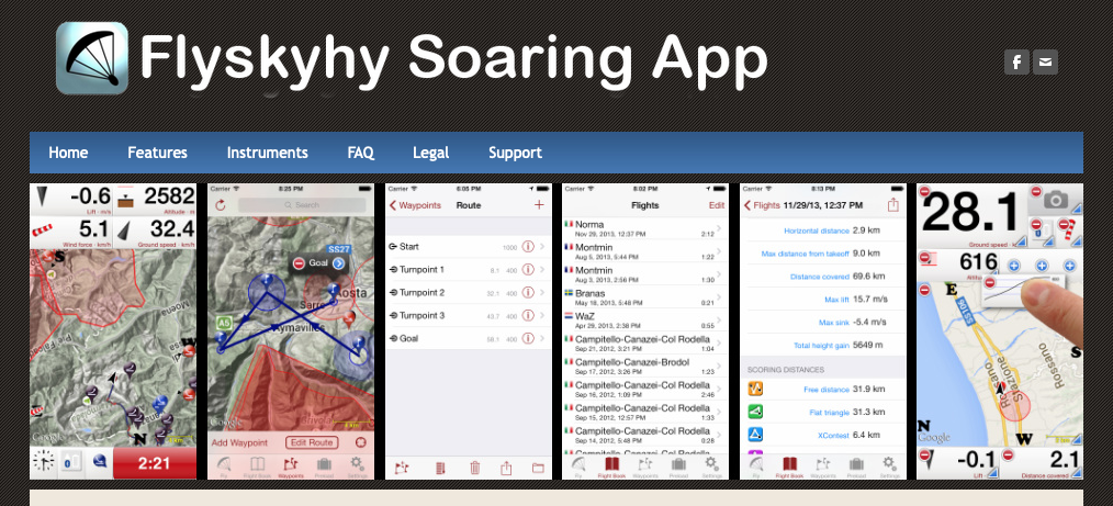
If you’re searching for the best paragliding app to enhance your flying experience, Flyskyhy might just be your new co-pilot. This top-rated app offers detailed flight data, real-time feedback, and easy integration with devices like variometers. If you’re planning an epic cross-country journey or just aiming to improve your flight logging, Flyskyhy has got you covered.
- Main Category: Flight Tracking & Logging
- Other Categories: Thermal & Lift Optimization, Navigation & Mapping
- Device Compatibility: iOS
- User Rating: ★★★★☆ (4.5/5)
- Price: Paid (No free version)
Why Flyskyhy Stands Out
Real-Time Flight Data: Imagine having live updates on your altitude, speed, glide ratio, and thermal activity—all at your fingertips. With Flyskyhy, you can make those crucial in-flight adjustments to keep you soaring.
Airspace Warnings: Safety first! The app integrates with airspace databases to alert you when you’re approaching or entering controlled airspace. Fly with confidence, knowing you’re in the clear.
Flight Logging and Playback: Automatically log your flights and relive them later with the replay feature. It’s like having a personal flight recorder, helping you analyze and refine your flying techniques.
Customizable Interface: Tailor your dashboard to focus on what matters most to you—be it altitude, thermals, or ground speed. After all, every pilot is unique, and your app should be too!
Integration with External Devices: Seamlessly connect with external variometers like XC Tracer for improved data accuracy. It’s perfect for pilots who crave precise information.
Apple Watch Companion: Got an Apple Watch? Flyskyhy extends its functionality to your wrist, letting you track basic flight data without constantly checking your phone.
Thermal Assistance: Planning a cross-country flight? The app includes tools for tracking thermals, helping you find those elusive lift zones to extend your airtime.
What Pilots Love About Flyskyhy
- Customizable Interface: Pilots rave about how easy it is to set up the display just the way they like it. Showcasing only the metrics you care about makes for a more enjoyable and focused flight.
- Accurate Flight Logging: The automatic flight logs and replay features are a hit. Reviewing your performance post-flight has never been simpler, allowing for continuous improvement.
- Device Integration: The smooth connection with devices like XC Tracer is a game-changer. Advanced pilots appreciate the precise data this integration provides.
Tips from Users – Paragliders
- Cost of Add-Ons: While the base app is packed with features, some essential extensions like airspace data or cross-country packages come at an extra cost.
- Interface Design: A few users feel the interface could use a modern refresh. Functions like zooming during playback aren’t as intuitive as some would like.
- High Battery Usage: Like many GPS-intensive apps, Flyskyhy can drain your battery faster than you’d expect. It’s something to keep in mind on those longer flights—maybe pack an extra power bank!
XCTrack – The Ultimate Paragliding App for Android Pilots
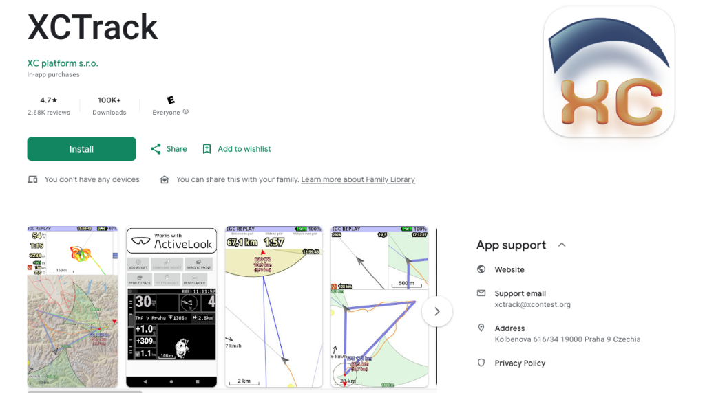
Android users, rejoice! If you’re on the hunt for one of the best paragliding apps to elevate your flying experience, look no further than XCTrack. Designed by pilots for pilots, this app is packed with features like live flight tracking, thermal assistance, and competition tools.
- Main Category: Flight Tracking & Logging
- Other Categories: Thermal & Lift Optimization, Navigation & Mapping, Community & Competitions, Weather & Wind Forecasting
- Device Compatibility: Android only
- User Rating: ★★★★☆ (4.6/5)
- Price: Free (Donations encouraged)
- Free Trial: Not applicable (fully free)
Why XCTrack is a Must-Have Paragliding App
Real-Time Flight Data: Stay informed with detailed live flight data, including altitude, speed, glide ratio, and more. The best part? You can customize it to display only the metrics that matter most to you.
Advanced Navigation & Mapping: Planning a cross-country adventure? XCTrack offers robust tools for navigation with offline maps, route planning, and waypoint management—even in the most remote locations.
Thermal Assistance: Finding that perfect thermal lift has never been easier. With real-time thermal tracking, you can optimize your climbs and extend your airtime.
Barometric Sensor Integration: If your device supports it, XCTrack utilizes barometric pressure sensors for ultra-accurate altitude readings, giving you an edge in precision.
Competition Tools: For the competitive spirits out there, XCTrack includes features like waypoint management and integration with XContest, making it a top choice among paragliding competition apps.
Automatic Task Scoring: Say goodbye to manual calculations! XCTrack automatically calculates and updates your scores based on live flight data and task completion.
Live Tracking: Keep connected with fellow pilots by sharing your real-time position. It’s not just about safety—it’s about community.
Customizable Dashboards: One size doesn’t fit all, and XCTrack knows it. Customize your dashboard for different flight types—be it competition, cross-country, or training—so you always have the right info at a glance.
What Pilots Love About XCTrack
- Comprehensive Customization: Pilots rave about the highly customizable interface. Whether you’re focusing on thermal gain, ground speed, or altitude, you can tailor the app to suit your needs perfectly.
- Competition Tools: If you’re into paragliding competitions, XCTrack is a game-changer. The specialized tools for waypoint management and live scoring make it a favorite among competitive pilots.
- Offline Maps: No signal? No problem! The ability to download maps for offline use is a lifesaver when flying in remote areas.
Tips from Pilots Reviews
- Learning Curve: XCTrack is packed with advanced features, which can be a bit overwhelming for beginners. But don’t worry—with a little practice, you’ll harness its full potential.
- Occasional Bugs: While the app is actively developed, some users have reported occasional glitches. The good news is updates are frequent, and the developers are responsive.
- Wind Data Accuracy: A few pilots have mentioned that wind speed and direction data can sometimes be off, which might impact flight planning.
TheFlightVario App – Turn Your Smartphone into a Paragliding Instrument
Ever thought about transforming your Android smartphone into a customizable paragliding instrument? TheFlightVario does just that! As one of the best free paragliding apps, it offers a suite of tools to give you real-time flight data without the need for expensive hardware.
- Main Category: Flight Tracking & Logging
- Other Categories: Thermal & Lift Optimization, Navigation & Mapping, Weather & Wind Forecasting
- Device Compatibility: Android only
- User Rating: ★★★★☆ (4.4/5)
- Price: Free
Why TheFlightVario is a Must-Have Paragliding App
Real-Time Flight Data: Get live feedback on critical flight metrics like altitude, climb rate, and glide ratio—all using your phone’s built-in sensors. No external devices needed!
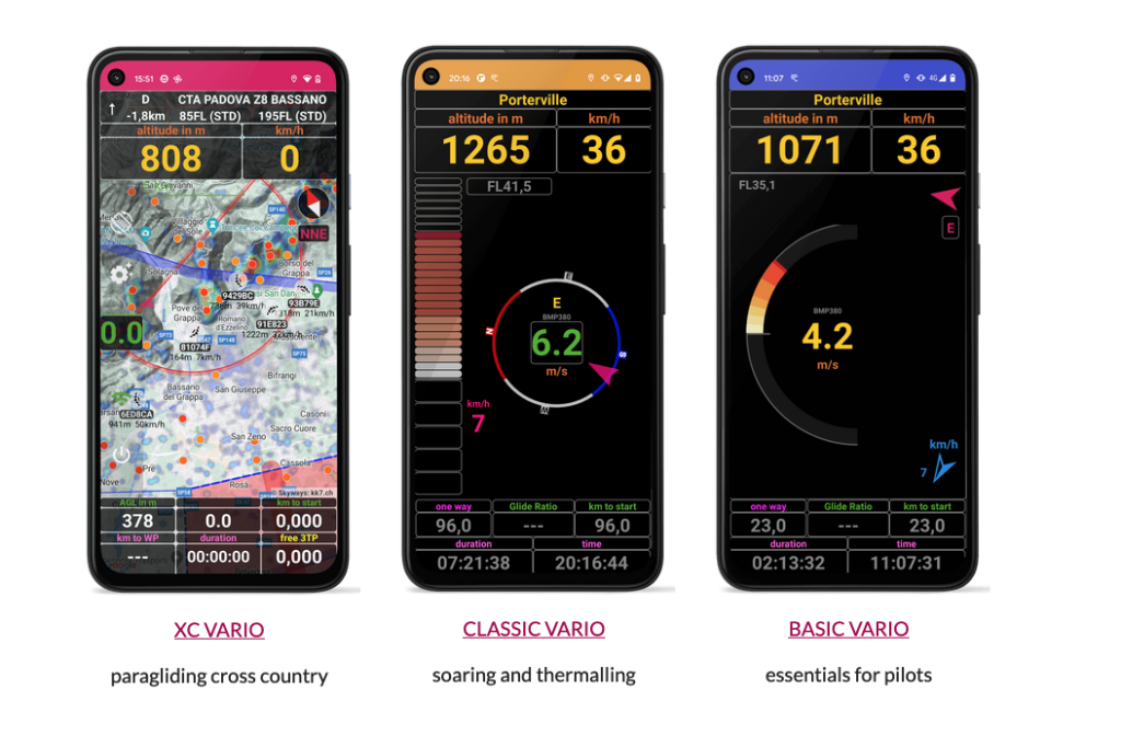
Customizable Interface: Choose from three different display modes—XC Vario, Classic Vario, and Basic Vario. Whether you’re into intense paragliding navigation or prefer a simpler setup, there’s an option for you.
Flight Logging: Record your flights for post-flight analysis. It’s a fantastic way to track your progress and improve your paragliding performance over time.
Cost-Effective Solution: Why invest in expensive flight instruments when you can get essential features for free? TheFlightVario makes paragliding more accessible to everyone.
Reviews – What Pilots Love About TheFlightVario
- Customizable Display: Pilots appreciate the flexibility to adjust the display according to their flight needs. Going for a cross-country adventure? Switch to XC Vario. Just soaring locally? Basic Vario has you covered.
- Free and Accessible: As a free app, it’s a hit among paragliders who want essential flight data without breaking the bank. It’s perfect for those starting out or anyone looking to save on gear.
- Easy Setup: The app’s intuitive interface makes it ideal for beginners, yet it doesn’t skimp on features that experienced pilots find useful.
Tips from Paragliders
- Accuracy Limitations: While the app does a great job using your smartphone’s sensors, it’s worth noting that it may not be as precise as dedicated flight instruments. If ultra-accurate data is crucial for you, consider this factor.
- Advanced Features: For the tech-savvy pilots seeking sophisticated features like thermal mapping or advanced weather forecasting, TheFlightVario might feel a bit basic.
Gaggle Flight Recorder – Track and Analyze Your Flights Like a Pro
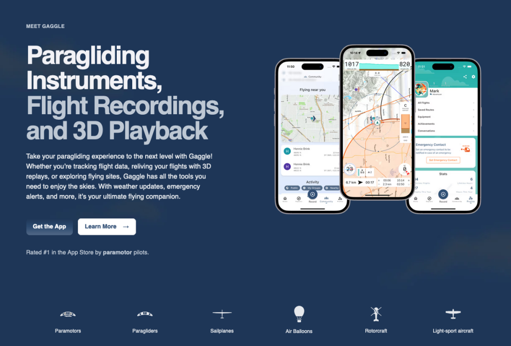
Ever wished you could replay your paragliding flights to see where you soared and where you could improve? Gaggle is here to make that happen! As one of the best paragliding apps available for both iOS and Android, Gaggle is a favorite among competitive pilots for its detailed tracking capabilities.
- Main Category: Flight Tracking & Logging
- Other Categories: Community & Competitions, Navigation & Mapping, Weather & Wind Forecasting
- Device Compatibility: iOS and Android
- User Rating: ★★★★☆ (4.9/5)
- Price: Free and Paid Versions Available
- Free Trial: N/A
Why Gaggle is a Must-Have Paragliding App
GPS Flight Tracking: Gaggle automatically records all your flight data, including altitude, speed, and route efficiency. No more manual logging—just focus on enjoying the flight!
IGC Export: Planning to enter competitions or analyze your flights in-depth? Gaggle supports the export of IGC files, which are essential for competition flight logs and further analysis.
Flight Playback & Analysis: Replay your flights to review performance and identify areas for improvement. It’s like having a personal flight coach right on your phone!
Real-Time Tracking: Share your live location with friends, family, or fellow pilots. Not only does this enhance safety, but it also lets others share in your flying adventures in real time.
Flight Data Sharing: Easily share your flight logs with fellow pilots or upload them to competition platforms like XContest. It’s a great way to join the paragliding community and see how you stack up.
Weather Forecast Integration: Stay ahead of the weather with integrated forecasts. Knowing wind conditions and thermal activity can make all the difference in planning your next flight.
What Paragliders Love About Gaggle – Reviews
- Detailed Flight Logging: Pilots love Gaggle’s accurate and comprehensive flight logs. Capturing all essential data makes post-flight analysis a breeze, and the IGC export feature is a big hit among competition pilots.
- Free Basic Version: Many appreciate that Gaggle offers a free version packed with useful features. It’s accessible to all pilots looking to improve their flight tracking without immediate investment.
Tips from User Reviews
- Limited Features in Free Version: While the free version is robust, advanced features like detailed analysis tools and real-time competition tracking are only available via in-app purchases. If you’re serious about leveraging all the app has to offer, consider upgrading.
- Occasional Stability Issues: Some users report that the app can occasionally crash during longer flights. The developers are active in rolling out updates, but it’s something to be aware of.
FlyMe – Your All-in-One Paragliding App for Android Pilots
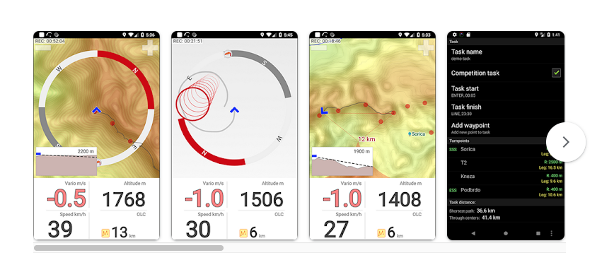
As one of the best paragliding apps available, FlyMe offers an extensive range of flight tools that cater to both casual flyers and seasoned pros. From real-time tracking to offline maps and thermal mapping, this app is a reliable companion for those epic cross-country flights.
- Main Category: Flight Tracking & Logging
- Other Categories: Navigation & Mapping, Thermal & Lift Optimization
- Device Compatibility: Android only
- User Rating: ★★★★☆ (4.8/5)
- Price: Free with premium options
- Free Trial: N/A
Why FlyMe Stands Out Among Paragliding Apps
Real-Time Flight Data: Keep an eye on live updates of your altitude, speed, and glide ratio during flights. It’s like having a personal flight instrument right in your pocket!
Offline Maps: No cell service? No problem! Access maps even in the most remote areas, ensuring your paragliding navigation is always on point.
Thermal Tracking: Searching for that perfect thermal lift to extend your airtime? FlyMe includes a world thermal map to help you locate lift zones with ease.
Airspace Alerts: Fly safely with side views of terrain and receive airspace warnings to avoid restricted zones. Safety first!
Task Editor for Competitions: For the competitive spirits, FlyMe supports tasks like FAI triangles and offers optimized path calculations. It’s a fantastic tool for your paragliding competitions.
Flight Logging: Log all your flight data for post-flight analysis. Review your performance, share with friends, or upload to your favorite paragliding community platforms.
What Pilots Love About FlyMe
- Offline Maps and Thermal Tracking: Pilots are thrilled with the combination of offline map capabilities and thermal tracking. It makes cross-country flying a breeze, especially in remote areas where signals are spotty.
- User-Friendly Navigation: FlyMe provides easy-to-use navigation tools and a clear interface, perfect for both casual pilots and competitive flyers looking for seamless paragliding navigation apps.
- Great Value: With extensive features available at no cost or with affordable premium upgrades, FlyMe is highly appreciated by budget-conscious pilots seeking a comprehensive paragliding app without breaking the bank.
Tips from User Reviews
- Limited to Android: Sorry iOS users, FlyMe is currently available only on Android. Some paragliders feel the lack of iOS support is a downside, but for Android users, it’s a gem!
- Premium Features Require Upgrade: While the free version offers plenty, some of the most useful tools – like more detailed maps and enhanced thermal tracking – are locked behind a paywall. If you’re looking to unlock the app’s full potential, consider upgrading to the premium version.
Paragliding Tracker: Wingman – Your Real-Time Flight Companion
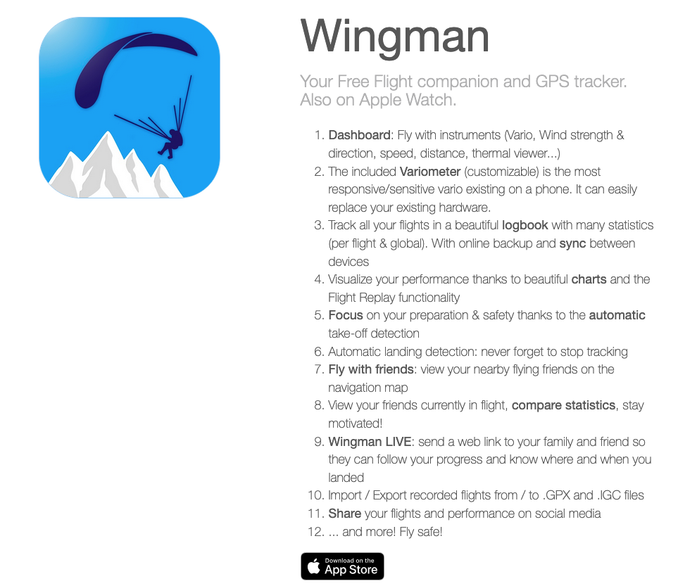
Looking for a paragliding app that keeps you connected and safe while soaring through the skies? Meet Wingman, one of the best paragliding apps for iOS pilots. Wingman offers real-time flight tracking and social features, ensuring both you and your loved ones can enjoy peace of mind during your flights.
/When you’re venturing into remote areas or just want friends and family to follow along in real-time, Wingman has got your back.
- Main Category: Flight Tracking & Logging
- Other Categories: Community & Competitions, Navigation & Mapping
- Device Compatibility: iOS
- User Rating: ★★★★☆ (4.7/5)
- Price: Free with premium options
- Free Trial: N/A
Why Wingman is a Must-Have Paragliding App
Real-Time Flight Tracking: With Wingman, your flight path is tracked via live GPS, allowing others to follow your journey in real-time. This feature is especially handy for cross-country flying, making it one of the top paragliding flight tracking apps out there.
SOS Feature: Safety is paramount in paragliding, and Wingman’s SOS feature enhances your security. In case of an emergency, the app sends your location data to designated contacts, ensuring help can find you quickly—even in remote locations.
Flight Sharing: Want to share your thrilling flights with friends, family, or fellow pilots? Wingman makes it easy to share your flight data, so others can track your progress or analyze your routes. It’s a fantastic way to engage with the paragliding community.
Offline Maps: Worried about losing signal in remote areas? Wingman supports offline maps, making it a reliable companion even when cellular service is spotty. Your paragliding navigation remains uninterrupted, keeping you on course.
What Pilots Love About Wingman
- Real-Time Tracking: Pilots appreciate the live tracking functionality, which not only enhances safety but also allows supporters to share in the excitement of the flight. It’s like having your own cheering squad!
- User-Friendly Interface: Wingman’s intuitive design makes it accessible for both beginners and seasoned paragliders. Navigating through its features is a breeze, so you can focus on what you love—flying!
- Emergency Features: The SOS feature is a standout, providing an added layer of safety. For those flying in remote areas, this can be a real lifesaver.
Tips from Experienced Paragliders
- Battery Usage: Real-time GPS tracking can be a bit heavy on battery consumption. If you’re planning a long flight, consider bringing a portable charger to keep your device powered up.
- Limited Offline Features: While Wingman does offer offline maps, some pilots feel that the offline capabilities could be expanded, especially regarding map detail and real-time updates.
xC Analytics – Dive Deep into Your Paragliding Performance
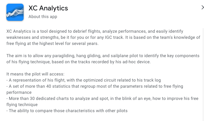
Ever wondered how much you could improve if you had a detailed breakdown of every flight? Meet xC Analytics, one of the best paragliding apps for pilots who are serious about refining their skills. This advanced app is designed to help you analyze every aspect of your flight performance, from thermalling to gliding and transitions.
If you’re a competitive pilot or someone eager to delve into the nitty-gritty of your flights, xC Analytics is your go-to tool.
- Main Category: Flight Tracking & Logging
- Other Categories: Community & Competitions, Thermal & Lift Optimization
- Device Compatibility: Android
- User Rating: ★★★★☆ (4.5/5)
- Price: Paid
- Free Trial: N/A
Why xC Analytics is a Standout Among Paragliding Apps
Detailed IGC Flight Data: xC Analytics provides in-depth analysis of your IGC flight data, breaking down metrics like altitude, speed, and glide ratio. It’s like having a personal coach reviewing every moment of your flight!
Flight Phase Analysis: Want to know exactly how you performed during thermalling, gliding, or transitions? This app dissects your flight into different phases, offering 63 unique flight statistics to help you fine-tune your performance.
Thermal Insights: Optimize your thermal lift usage with detailed thermal analysis. Cross-country pilots find this feature particularly invaluable for making smarter decisions in future flights.
Flight Comparisons: Compare multiple flights to identify patterns and trends. Whether you’re preparing for paragliding competitions or aiming to improve your cross-country flying, this feature helps you track your progress over time.
Visual Flight Path Representation: Visual learner? The app displays your flight paths with key performance indicators highlighted, helping you understand how each segment contributed to your overall performance.
What Paragliders Love About xC Analytics
- Comprehensive Flight Breakdown: Pilots rave about the detailed analysis, which offers insights into every aspect of their flight—from the efficiency of thermalling to the nuances of the final glide.
- Thermal Analysis: The thermal insights are a game-changer. By evaluating lift efficiency, pilots can make better decisions and optimize their flights like never before.
- Flight Comparisons: The ability to compare different flights and spot trends is a hit among competitive pilots. It’s a powerful tool for enhancing technique and staying ahead of the competition.
Advice for Beginners
- Overwhelming Detail: If you’re new to paragliding or not yet familiar with advanced flight metrics, the level of detail might feel overwhelming at first. But don’t worry—with time, you’ll find that this depth of information can significantly accelerate your learning curve.
Wingit – Live Tracking and Flight Sharing for Paragliders
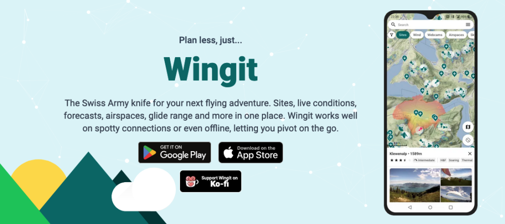
Looking to share your paragliding adventures in real-time with friends, family, and fellow pilots? Wingit is here to make that happen! Designed for both paragliders and hang gliders, Wingit focuses on live tracking and flight sharing, making it one of the best paragliding apps for those who love to stay connected while soaring through the skies.
- Main Category: Live Flight Tracking
- Other Categories: Flight Sharing, Navigation, Weather Integration
- Device Compatibility: Android and iOS
- User Rating: ★★★★☆ (4.6/5)
- Price: Free (with in-app purchases)
Why Wingit App?
Live Tracking: Share your flight live with friends, family, or the wider paragliding community. This real-time tracking feature not only enhances safety but also adds an extra layer of excitement as others can follow your journey.
Route Planning & Navigation: Easily plan your flight routes and monitor your progress with built-in paragliding navigation apps features. Get alerts about waypoints and track your exact course to ensure a smooth flight.
Thermal Tracking & Lift Prediction: Maximize your thermal lift opportunities with advanced weather integrations that help predict thermals and lift. It’s a game-changer for those epic cross-country flying adventures.
Community Engagement: Connect with other pilots, share flight experiences, and discover new spots via the Wingit community. It’s not just about flying; it’s about joining a network of enthusiasts who share your passion.
Weather Integration: Stay ahead of the weather with real-time updates, including wind speed and direction. Ensuring you’re flying in the best possible conditions has never been easier.
What Pilots Love About Wingit
- Live Tracking: Pilots appreciate how effortlessly they can share flights live, enhancing both safety and fun. It’s like having your own support crew cheering you on!
- Thermal and Weather Integration: The app’s real-time weather updates and thermal predictions are particularly useful for cross-country flying, helping you make informed decisions on the go.
- Community Engagement: The ability to connect with other pilots, share routes, and discover new flying spots adds a social dimension that pilots find incredibly rewarding.
Tips from Pilots
- Limited Offline Features: Without a strong signal, some features may be less reliable, especially in remote flying areas. If you often fly in places with spotty coverage, this is something to consider.
- Data Usage: The live tracking feature can consume a fair amount of mobile data. For those on limited data plans or flying in areas with poor connectivity, this might be a drawback.
Paragliding Navigation & Mapping Apps
Now that we’ve explored flight tracking, let’s shift gears to the paragliding navigation apps that help you navigate like a pro. These tools offer detailed GPS tracking, airspace awareness, and terrain mapping to keep you on the right path.
Planning a cross-country flying adventure or trying to avoid restricted areas? These apps provide real-time route adjustments, waypoints, and even offline maps. Many also feature thermal mapping and competition tools, ensuring you’re informed and making the most of every flight. With these apps, you can fly smarter, safer, and plan more efficient routes.
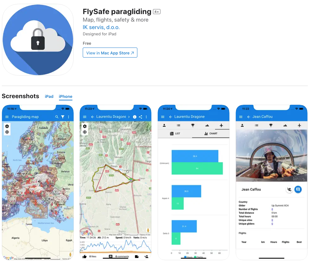
FlySafe – Airspace Awareness for Paragliders in the UK
If you’re paragliding in the UK, FlySafe is an essential companion to keep you compliant and safe. This app provides real-time airspace information, helping you navigate through the complex web of controlled zones and restrictions. Designed for free-flight pilots – including paragliders and hang gliders – FlySafe ensures you’re always in the know about the skies you’re exploring.
- Main Category: Navigation & Mapping
- Other Categories: Safety & Emergency Assistance
- Device Compatibility: iOS and Android
- User Rating: ★★★★☆ (4.5/5)
- Price: Free (donations welcomed)
Why FlySafe is a Must-Have Paragliding App
Airspace Awareness: Stay updated with the latest UK airspace restrictions, including controlled zones, no-fly areas, and NOTAMs. It’s like having a personal air traffic controller in your pocket!
Real-Time Notifications: Receive instant alerts for airspace changes or temporary restrictions that could affect your flight. This feature is a game-changer for staying safe while soaring the skies.
Detailed Airspace Maps: Navigate with confidence using interactive maps featuring clear visual markers for restricted or regulated zones.
Flight Planning: Plan your routes effectively by viewing open and restricted airspaces before takeoff. Ensure you’re always flying within legal boundaries.
What Pilots Love About FlySafe
- Comprehensive Airspace Data: Pilots appreciate the detailed maps and real-time updates, making safe flight planning a breeze.
- User-Friendly Interface: The app is straightforward and easy to navigate, providing quick access to crucial information without overwhelming you.
- Essential for UK Pilots: Many UK paragliders consider FlySafe indispensable for avoiding restricted zones and staying compliant with local regulations.
Tips from Experienced Paragliders
- Limited to the UK: While incredibly useful in the UK, the app doesn’t offer functionality for international airspace, which might be a drawback if you fly abroad.
- Lacks Advanced Features: Some advanced pilots wish for additional features like thermal tracking or flight logging. FlySafe is primarily a safety tool rather than a comprehensive flight app.
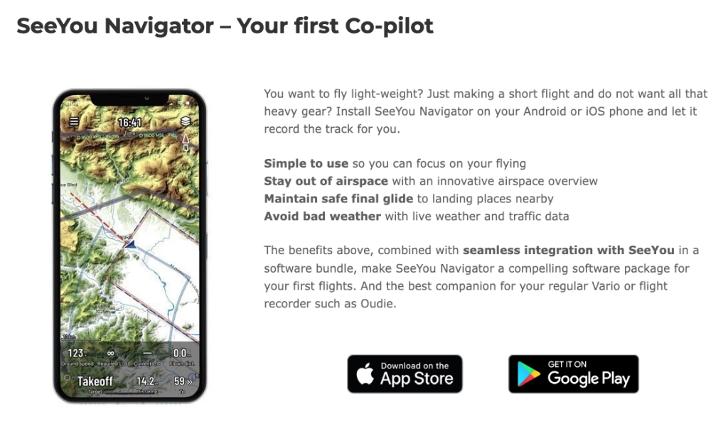
SeeYou Navigator App – Real-Time Navigation for Paragliders
Looking for a comprehensive paragliding navigation app that offers real-time GPS guidance, airspace awareness, and competition tools? SeeYou Navigator might just be your perfect match. Developed by Naviter, this app integrates seamlessly with popular devices and platforms like Flymaster and XCSoar, making it a top choice for both recreational and competitive pilots.
- Main Category: Navigation & Mapping
- Other Categories: Flight Tracking & Logging, Community & Competitions
- Device Compatibility: iOS and Android
- User Rating: ★★★★☆ (4.3/5)
- Price: Free with Paid Features
- Free Trial: Yes
Why SeeYou Navigator Stands Out
Real-Time GPS Navigation: Stay on course with live GPS tracking and real-time adjustments based on flight conditions. It’s like having a personal navigator guiding you through the skies.
Airspace and Map Data: Access preloaded airspace maps and terrain data to avoid restricted areas and navigate safely.
Thermal Assistance: Maximize your lift during cross-country flying with thermal tracking and forecasting features.
Flight Logging & IGC Export: Automatically log your flight data for review and export in IGC format—perfect for competitions and detailed analysis.
Cloud Syncing: Sync your flight data to the cloud, allowing you to review and access it from multiple devices.
What Pilots Like About SeeYou Navigator
- Reliable Navigation: Pilots love the seamless GPS integration, making it easy to follow flight paths and comply with airspace regulations.
- Preloaded Airspace Maps: Detailed maps keep you informed about restricted areas, which is especially useful during competitions.
- IGC Export: The ability to export flight data in IGC format simplifies post-flight reviews and scoring, a favorite among competition pilots.
Tips from App Users
- Subscription Required: While there’s a free trial, many essential features are behind a subscription paywall. If you’re serious about leveraging all the app offers, consider investing in the premium version.
- Learning Curve: Some beginners find the extensive features a bit overwhelming at first. Spend some time exploring the app to get the most out of it.
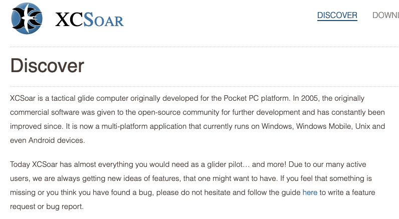
XCSoar – Open-Source Paragliding Navigation App
For those who love customization and flexibility, XCSoar is an open-source paragliding navigation app that offers advanced tools for cross-country flying and competitions. Designed for paragliders, hang gliders, and sailplane pilots, XCSoar is a community-driven platform constantly evolving with user contributions.
- Main Category: Navigation & Mapping
- Other Categories: Flight Tracking & Logging, Thermal & Lift Optimization, Community & Competitions
- Device Compatibility: Android, Windows
- User Rating: ★★★★☆ (4.5/5)
- Price: Free (Donations encouraged)
Why XCSoar is a Top Choice Among Paragliding Apps
Cross-Country Navigation: Benefit from advanced waypoint management, task planning, and competition tools—ideal for serious cross-country and competitive pilots.
Thermal Assistance: Optimize your climb and flight duration with real-time thermal detection and tracking.
Offline Maps: Download maps for offline use, ensuring you’re never lost even in remote areas with limited connectivity.
Highly Customizable Interface: Tailor the display to show essential data like altitude, speed, and thermal gain. It’s your cockpit, set it up your way!
Open-Source Platform: Being open-source, XCSoar is continuously improved by the community, offering regular updates and new features.
Pilot Ranking: Upload your flight data directly and see how you stack up against other pilots worldwide through integrated ranking systems like the Leonardo platform.
Multilingual Support: With support for multiple languages, XCSoar is accessible to pilots globally, not just those fluent in English.
What Paragliding Pilots Like About XCSoar
- Customizable Display: Pilots love the ability to customize the interface to display exactly what they need during flight.
- Free and Open-Source: Users appreciate that such a powerful app is free and continuously evolving thanks to community contributions.
- Comprehensive Competition Tools: The app’s tools for task planning and thermal assistance are often highlighted as top features for competitive flying.
Tips from Experienced Pilots
- Steep Learning Curve: With its advanced features and customization options, XCSoar can be challenging to navigate initially, especially for beginners. But don’t let that deter you—the payoff is worth it!
- Occasional Bugs: While regularly updated, some users have reported bugs that can affect performance during flights. These are typically resolved in future updates, thanks to the active community.
Air Navigation Pro – Your Ultimate Flight Navigation Companion
Looking for a reliable co-pilot to guide you through the skies? Air Navigation Pro is one of the best paragliding apps out there, widely used not just by paragliders but by aviators of all kinds. This comprehensive app offers a full suite of in-flight navigation tools, making it a go-to choice for pilots seeking dependable navigation, route planning, and safety features.

- Main Category: Navigation & Mapping
- Other Categories: Flight Tracking & Logging, Safety & Emergency Assistance
- Device Compatibility: iOS, Android, Microsoft
- User Rating: ★★★★☆ (4.5/5)
- Price: Free with premium subscription options
- Free Trial: Yes, for 28 days!
Why Air Navigation Pro is a Must-Have Paragliding App
Real-Time Navigation: Get detailed real-time GPS navigation showing your flight paths, waypoints, and airspace information. It’s like having an advanced cockpit instrument right on your device!
Airspace Alerts: Stay safe with alerts when you’re entering controlled or restricted airspaces. This feature ensures you maintain safe and legal flight paths, which is especially crucial near busy airspaces.
Offline Maps: No signal? No worries! Air Navigation Pro offers high-resolution offline maps for various regions, allowing you to navigate even when you’re off the grid.
Flight Planning: Pre-plan your routes with ease, including waypoints and weather conditions. This ensures a smooth and efficient flight, helping you focus on enjoying the journey.
Customizable Instruments: Tailor the app to display essential flight data like altitude, speed, and glide ratio—just the way you like it. Personalize your dashboard to suit your flying style and preferences.
What Paragliders Like About Air Navigation Pro
- Comprehensive Navigation: Paragliders appreciate the app’s detailed navigation features, which are incredibly helpful for cross-country flying and paragliding competitions.
- Offline Map Support: The ability to use offline maps is a huge plus, especially when flying in remote areas with limited connectivity. It keeps your paragliding navigation reliable wherever you go.
- Airspace Awareness: The app’s airspace alerts help pilots avoid violations, ensuring safe flying. It’s like having an extra set of eyes watching out for restricted zones.
Feedback from Experienced Paragliders
- Cost of Premium Features: While the free version is helpful, many of the most useful tools—like additional maps and detailed weather overlays—require a paid subscription. If you’re serious about leveraging all that Air Navigation Pro offers, consider investing in the premium version.
- Battery Usage: The app’s GPS and real-time tracking features can drain your battery on longer flights. It’s wise to carry a portable charger if you’re planning extended flying sessions.
- Learning Curve: Some beginners find the interface a bit complex due to the wide range of features available. Spending some time exploring the app can help you get the most out of it.
Paragliding Map – Discover the Best Launch Sites Worldwide
Dreaming of exploring new horizons? Paragliding Map is your passport to over 15,000 launch sites and 7,500 landing zones around the globe! As one of the top paragliding apps for finding launch and landing zones, it offers real-time weather updates, user reviews, and detailed site information. If you’re a seasoned pilot or just starting out, this app is a must-have for planning your next adventure.
Test it out live below.
- Main Category: Navigation & Mapping
- Other Categories: Weather & Wind Forecasting, Flight Tracking & Logging
- Device Compatibility: iOS and Android
- User Rating: ★★★★☆ (4.1/5)
- Price: Free with premium options
- Free Trial: Yes
Why Paragliding Map is a Must-Have App
Launch Site Database: Access an extensive database of over 15,000 launch sites and 7,500 landing zones worldwide. You’ll never run out of new places to explore!
Real-Time Weather: Get up-to-date weather information from trusted sources like MeteoBlue and Windy. Knowing the current conditions helps you choose the perfect time and place to fly.
Filters for Flight Conditions: Customize your search by wind direction, flight style, and altitude to find the ideal site that matches your preferences.
Pilot Reviews and Feedback: Read reviews from fellow paragliders to assess sites before you fly. Discover hidden gems and avoid potential pitfalls through community insights.
SOS Feature: Safety first! Send out emergency signals with your GPS coordinates if you run into trouble during a flight.
What Pilots Love About Paragliding Map
- Global Coverage: Pilots love the extensive coverage of launch and landing zones worldwide. It’s a go-to app for traveling pilots looking to discover new spots.
- Real-Time Weather Integration: The integration with multiple forecast providers offers accurate, up-to-date weather information, which is crucial for safe flying.
- User Reviews and Feedback: Being able to read reviews and feedback from other paragliders helps pilots assess new sites, making informed decisions about where to fly.
Tips from User Reviews
- Free Features: Some features, like offline maps and more detailed weather data, are locked behind a premium paywall. If you need these advanced features, you might consider upgrading. Which is well worth it!
Hike and Fly Paragliding Apps
Ever thought about combining your love for hiking with the thrill of paragliding? Hike and fly apps are perfect for planning routes that seamlessly blend both adventures.
These apps offer detailed trail maps, elevation profiles, and offline navigation to help you find the best launch sites and assess the terrain. While they might not be paragliding-specific, many pilots use these tools to explore new terrains, elevations, and potential launching spots.
Some of the best paragliding launch sites are not accessible by other means of transportation, so it’s just you and your two feet! Let’s look into some of the best paragliding apps that cater to your hike-and-fly needs!
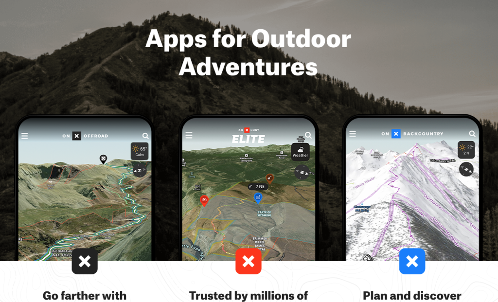
onX Maps – Advanced Terrain Mapping for Paragliding Pilots
onX Maps is a fantastic resource for paragliders navigating remote or mountainous regions. Originally popular among hikers and hunters, its 3D mapping, offline access, and public/private land boundaries make it a gem for pilots like you.
- Main Category: Hike and Fly
- Other Categories: Navigation and Mapping
- Device Compatibility: Android
- User Rating: ★★★★☆ (4.7/5)
- Price: Free with premium options
- Free Trial: Yes
Why onX Maps App?
3D Terrain Mapping: Visualize elevation changes and potential launch and landing zones with detailed 3D maps. It’s like scoping out the terrain before you even lace up your boots!
Offline Maps: Heading into remote areas with no cell service? No problem! Download topographic, satellite, and terrain maps for offline use, ensuring reliable navigation wherever you go.
Public and Private Land Boundaries: Avoid trespassing and restricted airspace by knowing exactly where public and private lands begin and end. It’s peace of mind right in your pocket.
Custom Waypoints: Mark key points like launch sites, landing zones, or interesting spots along your route. Personalize your map to fit your adventure.
What Users Love About onX Maps
- Detailed 3D Terrain Maps: Pilots appreciate the high-resolution 3D maps that help plan safer and more efficient flights.
- Offline Functionality: The ability to use the app offline is a favorite among those flying in remote areas.
- Land Boundary Information: Knowing public and private land boundaries helps avoid potential airspace restrictions, making your flight smoother.
Tips from Experienced Paragliders
- Lacks Paragliding-Specific Features: While excellent for terrain mapping, onX Maps doesn’t offer flight-specific tools like real-time tracking or flight logs.
- Subscription Required: Some key features, like advanced terrain analysis and offline maps, are behind a paywall. If you need these advanced tools, consider investing in the premium version.
MapOut – Offline Mapping App for Hike-and-Fly
If you’re an iOS user seeking a simple yet powerful mapping app, MapOut might be your perfect match. Designed primarily for hikers, it has become a favorite among hike-and-fly paragliders due to it’s ease of use, high-quality maps, and detailed elevation profiles.
Check out the MapOut Demonstration and Overview video :
- Main Category: Hike and Fly
- Other Categories: Navigation & Mapping
- Device Compatibility: iOS only
- User Rating: ★★★★★ (5/5)
- Price: Paid
- Free Trial: Not applicable
Why MapOut is a Top Choice for Paragliders
Offline Maps: Easily download detailed maps for offline use. Perfect for paragliding in remote locations with limited connectivity.
Topographic Detail: Assess elevation changes and flight paths with high-resolution topographic maps. It’s like having a detailed terrain guide in your hand.
Customizable Routes: Plan and save custom routes with waypoints. You can even view real-time tracking during your hike or flight.
Elevation Profiles: Analyze the difficulty of hike-and-fly routes with detailed elevation profiles. Know what you’re getting into before you start!
What Pilots Say About MapOut
- Offline Functionality: The ability to use offline maps is a game-changer for pilots in remote areas.
- Simple Interface: MapOut’s user-friendly design makes it accessible for those looking for a straightforward mapping tool without unnecessary bells and whistles.
- Detailed Topographic Maps: Pilots appreciate the detailed elevation profiles when assessing challenging hike-and-fly routes.
Tips from Paragliding Pilots
- iOS Only: Unfortunately for Android users, MapOut is exclusive to iOS.
- No Paragliding-Specific Features: While great for mapping, it lacks flight-specific tools like thermal tracking or live weather updates. But it works great for Hike and Fly.
AllTrails – Mapping App for Hike-and-Fly Paragliders
If you’re looking for an app with an extensive database of trails, AllTrails is a fantastic choice. Widely used among outdoor enthusiasts, including paragliding pilots, AllTrails helps you find and navigate hiking routes leading to launch sites. Plus, its detailed reviews and user-submitted photos are especially helpful when exploring new areas.

- Main Category: Hike and Fly
- Other Categories: Navigation & Mapping
- Device Compatibility: iOS and Android
- User Rating: ★★★★☆ (4.8/5)
- Price: Free with premium options
- Free Trial: Yes
Why AllTrails is a Must-Have App for Paragliders
Trail Discovery: Find thousands of trails complete with user reviews, difficulty ratings, and elevation data—ideal for discovering new hike-and-fly routes.
GPS Tracking: Real-time GPS tracking ensures you stay on the right path while hiking or descending after a flight.
Offline Maps: Download maps for offline access, making it useful in remote areas with little or no connectivity.
Elevation and Weather Information: Plan a safe and enjoyable hike to launch sites with detailed data on elevation gain and weather conditions.
What Pilots Like About AllTrails
- Detailed Trail Maps: Pilots love the comprehensive trail maps, crucial for navigating remote hike-and-fly locations.
- Offline Maps: The offline functionality ensures you have access to maps even without cell coverage.
- User Reviews and Photos: Get helpful insights into trail conditions, difficulty, and weather patterns from fellow users.
Tips from User Reviews
- Not Paragliding-Specific: While useful for hike-and-fly, AllTrails lacks paragliding-specific features like flight tracking or thermal mapping.
- Subscription Required for Premium Features: Advanced features like offline maps and detailed weather reports require a subscription.
PeakFinder – Identify Peaks in Real-Time
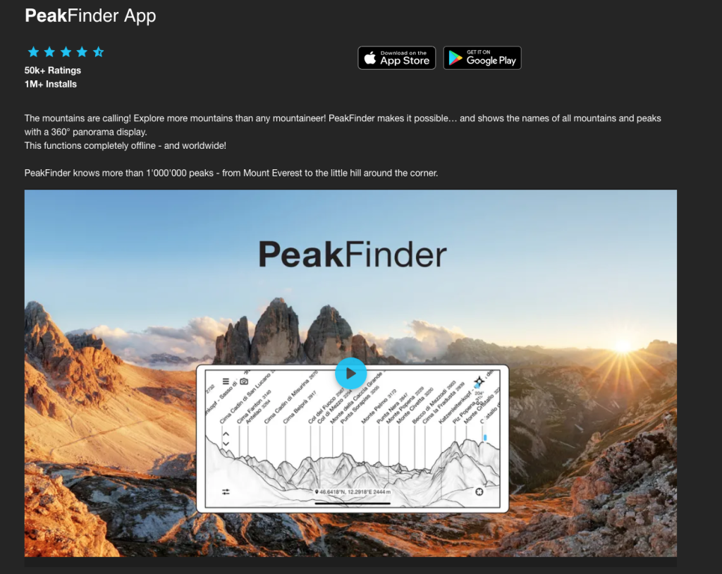
Ever gazed at the mountains around you and wondered what peaks you’re seeing? PeakFinder brings augmented reality (AR) to your paragliding adventures, helping you identify peaks in mountainous regions. It’s a handy tool for understanding your surroundings and planning safe paragliding flights.
- Main Category: Hike and Fly
- Other Categories: Navigation & Mapping
- Device Compatibility: iOS, Android
- User Rating: ★★★★☆ (4.7/5)
- Price: Paid
- Free Trial: No
Why PeakFinder is a Great Addition to Your Toolkit
Augmented Reality (AR): Use your phone’s camera to identify surrounding peaks in real-time, including names and elevations. It’s like having a personal mountain guide!
Offline Functionality: Download peak data for offline use, making it ideal for remote locations without cell service.
Global Database: Access information on over 800,000 peaks worldwide. No matter where you fly, PeakFinder has you covered.
3D Panorama Views: Explore panoramic mountain views to visualize flight routes and assess the landscape.
What Pilots Say About PeakFinder
- Real-Time Peak Identification: Instant identification of peaks helps pilots orient themselves during flights, especially in unfamiliar or mountainous areas.
- Offline Capability: Essential for pilots flying in remote regions with limited or no connectivity.
- Wide Global Coverage: The vast database ensures detailed peak data wherever you are.
Tips from Paragliding Pilots
- Not Paragliding-Specific: While great for identifying mountains, it lacks features tailored specifically for paragliding, such as thermal tracking or flight logging.
- Limited Use in Flat Areas: Its usefulness decreases in areas without significant mountain ranges.
Gaia GPS – Advanced Mapping & Navigation App
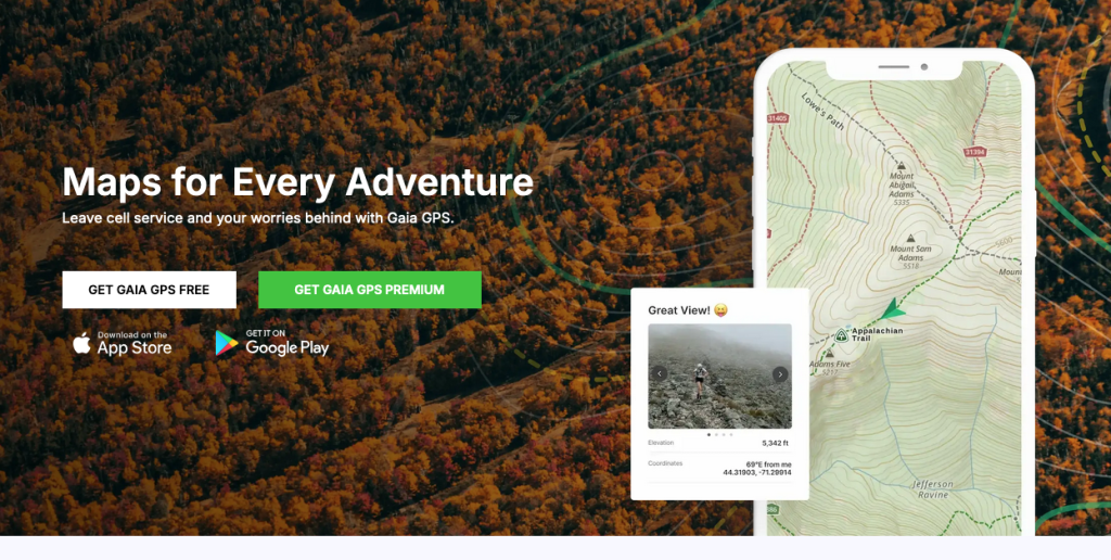
For those seeking a versatile mapping app with precise tools and offline capabilities, Gaia GPS is a top contender. Popular among hikers and outdoor enthusiasts, it’s also ideal for paragliders flying in remote regions.
- Main Category: Navigation & Mapping
- Other Categories: Hike and Fly, Safety & Emergency Assistance
- Device Compatibility: iOS and Android
- User Rating: ★★★★☆ (4.8/5)
- Price: Free with premium options
- Free Trial: Yes
Gaia GPS Features
Offline Maps: Download detailed topographic and satellite maps for offline use. Navigate confidently even in areas with no cell service.
Route Planning & Real-Time Tracking: Plan flight paths and track your current location in real-time, crucial for navigating complex terrains during paragliding flights.
Customizable Waypoints: Mark launch and landing sites, track thermal zones, or note emergency stops. Personalize your map to suit your flight.
SOS Feature: Integrate with messaging apps or satellite devices to send emergency location data to contacts in case of an accident.
Pilot’s Feedback About Gaia GPS
- Offline Functionality: Essential for flying over remote areas without mobile coverage.
- Accurate Mapping: Detailed topographical maps and terrain information allow for better flight planning and increased confidence.
- Customizable Waypoints: Pilots enjoy marking and tracking specific locations to optimize flight routes.
App User Reviews and Tips
- Subscription Needed for Full Access: Some essential features require a premium subscription, like advanced weather overlays or high-resolution maps.
- Not Paragliding-Specific: While highly useful, Gaia GPS isn’t designed specifically for paragliding and lacks flight logging or live weather features some pilots may desire.
Thermal & Lift Optimization Apps
Want to stay airborne longer and make the most out of every flight? Thermal & Lift Optimization apps are your secret weapon! These tools help paragliding pilots like you identify and track thermals, offering real-time data on thermal activity.
With detailed thermal maps and forecasting features, you can plan your flight more effectively, making those cross-country journeys smoother and more enjoyable. Let’s dive into some of the best paragliding apps that specialize in thermal and lift optimization.
Read more on Springtime Soaring: Navigating the Dynamic Skies of the UK
Paraglidable – Your Go-To App for Thermal Forecasts and Paragliding Weather
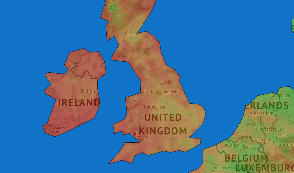
Looking to find the best flying conditions with ease? Paraglidable is a specialized app that provides thermal forecasts and weather data tailored specifically for paragliders. With this handy tool, you can easily check thermal strength, wind direction, and cloud cover across various locations.
It’s designed to help you identify optimal launch windows and ensure safe, enjoyable flights.
- Main Category: Thermal & Lift Optimization
- Other Categories: Weather & Forecasting
- Device Compatibility: Android
- User Rating: N/A
- Price: Paid (No free version)
Paraglidable Features
Thermal Strength and Wind Forecasts: Get accurate predictions on thermal strength and wind conditions to plan your flights effectively. No more guesswork—know exactly when and where to fly.
User-Friendly Interface: With a clear and intuitive interface, checking flight conditions becomes a breeze. Even if you’re new to paragliding, you’ll find it easy to navigate.
Flight Planning Based on Forecast Data: Use the app’s detailed forecasts to plan your flights in different locations. It’s like having a personal meteorologist focused solely on your flying needs.
What Paragliders Choose Paraglidable
- Accurate Thermal and Wind Predictions: Pilots appreciate the app’s reliability in forecasting, which helps them make informed decisions and maximize their flight time.
- Convenient Flight Planning: The ability to plan flights based on precise data makes Paraglidable a valuable tool for pilots flying in various locations.
Tips from Paragliding Users
- Limited Features in Free Version: Paraglidable is a paid app with no free version. While it offers specialized features, some pilots might prefer trying out an app before purchasing.
- Location Coverage: Currently, Paraglidable focuses on Europe only. If you’re flying elsewhere, you might need to look for alternative apps that cover your region.
XC Therm – Optimize Flights with Advanced Thermal Forecasting
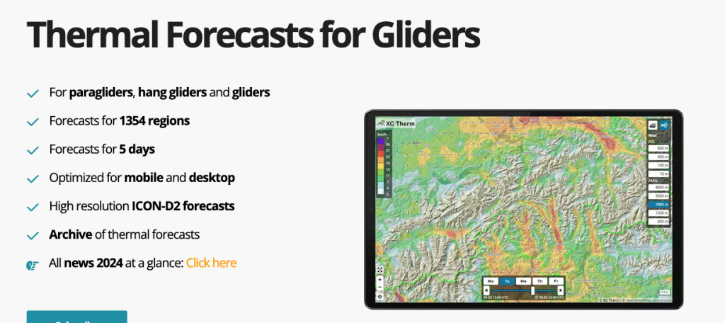
Imagine having detailed thermal forecasts right at your fingertips, helping you soar higher and stay airborne longer. XC Therm is a unique web-based app designed to do just that. As a Progressive Web App (PWA), it runs directly in your browser and can be saved to your phone’s home screen, making it as accessible as any native app without the need for app store downloads.
- Main Category: Thermal & Lift Optimization
- Device Compatibility: Web-based (PWA)
- Price: Paid
Why XC Therm is a Top Choice for Paragliding Pilots
Thermal Forecasting: Get real-time thermal predictions to locate lift zones during your flights. It’s like having a thermal map guiding you to the best spots in the sky.
User-Friendly Interface: The app boasts an easy-to-use interface that behaves like a native app once saved to your home screen. No steep learning curves here!
Weather Data Integration: XC Therm includes essential weather conditions like wind direction and temperature to aid in comprehensive flight planning.
Why Paragliders Choose XC Therm
- Accessibility: No need to clutter your device with more app downloads. Just save XC Therm to your home screen and access it whenever you need.
- Accurate Thermal Forecasts: Pilots praise the app’s detailed and real-time thermal data, which is crucial for optimizing flight paths and maximizing airtime.
Tips from Pro Paragliders
- Web-Based Limitations: While convenient, some users might prefer a fully native app experience. Being web-based, it may not offer all the functionalities of a dedicated app.
- Offline Functionality: XC Therm requires an internet connection to access forecasts. This could limit its use in remote areas where connectivity is sparse.
Weather & Wind Forecasting Apps
Ever wondered how to make your flights safer and more efficient? Weather & Wind Forecasting apps are essential tools for paragliders like you, providing real-time updates on weather conditions, wind speeds, and thermals.
These apps offer precise forecasts, visual weather maps, and customizable alerts to keep you informed about ideal flying conditions or potential risks. Let’s explore some of the best paragliding apps in this category that can help you plan your next adventure.
For more on Paragliding Weather – Paragliding Meteorology: A Beginner’s Guide
Windy.app – Accurate Weather and Wind Forecasts for Paragliders
When it comes to reliable weather forecasting, Windy.app is one of the top paragliding apps you don’t want to fly without. Offering real-time wind and weather data, this app is a must-have for pilots looking to track conditions before heading out. With detailed wind maps, weather charts, and global forecast coverage, Windy.app ensures you’re always in the know.
Watch Windy.app Demo:
- Main Category: Weather & Wind Forecasting
- Other Categories: Navigation & Mapping
- Device Compatibility: iOS, Android
- User Rating: ★★★★☆ (4.7/5)
- Price: Free with premium options
- Free Trial: Yes
Why Windy.app for Paragliding?
Real-Time Wind and Weather Data: Get live updates on wind speed, wind direction, temperature, cloud cover, and other key weather conditions. Knowing the current weather helps you make informed decisions for a safer flight.
Global Coverage: With detailed forecasts for over 30,000 spots worldwide, you can monitor weather conditions no matter where your cross-country flying takes you.
Weather Visualization: Windy.app uses colorful, visual wind maps and weather charts that are easy to interpret, helping you plan your paragliding flights accordingly.
Wind Alerts and Widgets: Set custom wind alerts to notify you when conditions meet your ideal parameters. Add widgets to your phone’s home screen for quick weather checks—it’s all about convenience!
Wind Rose Visualizations: Visualize how wind speeds and directions change throughout the day at your flying site. This helps in deciding optimal launch times and enhances your paragliding navigation.
Forecast Models: The app integrates multiple forecast models, including GFS, ECMWF, and ICON, ensuring accurate and reliable data for various regions.
Atmospheric River Forecasts: Unique forecasting features like atmospheric river tracking help you understand how larger weather systems influence wind and cloud patterns in your region.
Windy.app Features
- Highly Accurate Weather Forecasts: Users consistently praise Windy.app for its precision in tracking wind and weather data, which is crucial for planning safe paragliding flights.
- Wide Range of Features: The app provides a broad range of weather-related data, from wind gusts to cloud cover, making it a comprehensive tool for all types of outdoor sports.
- Global Spot Coverage: With forecasts available for over 30,000 locations, you can find weather information for almost any flying site in the world.
- Customizable Alerts: Pilots appreciate the custom wind alerts, allowing them to receive notifications when conditions meet their flight preferences.
Insider Tips from User Reviews
- Subscription Model: Some essential features, like detailed wind data and extended forecasts, are locked behind a paywall. If you need these advanced features, consider investing in the premium subscription.
- Complex for Beginners: While packed with features, some pilots find the app’s interface a bit overwhelming if they’re not familiar with advanced meteorological data.
Meteoblue – Advanced Weather Forecasting for Paragliders
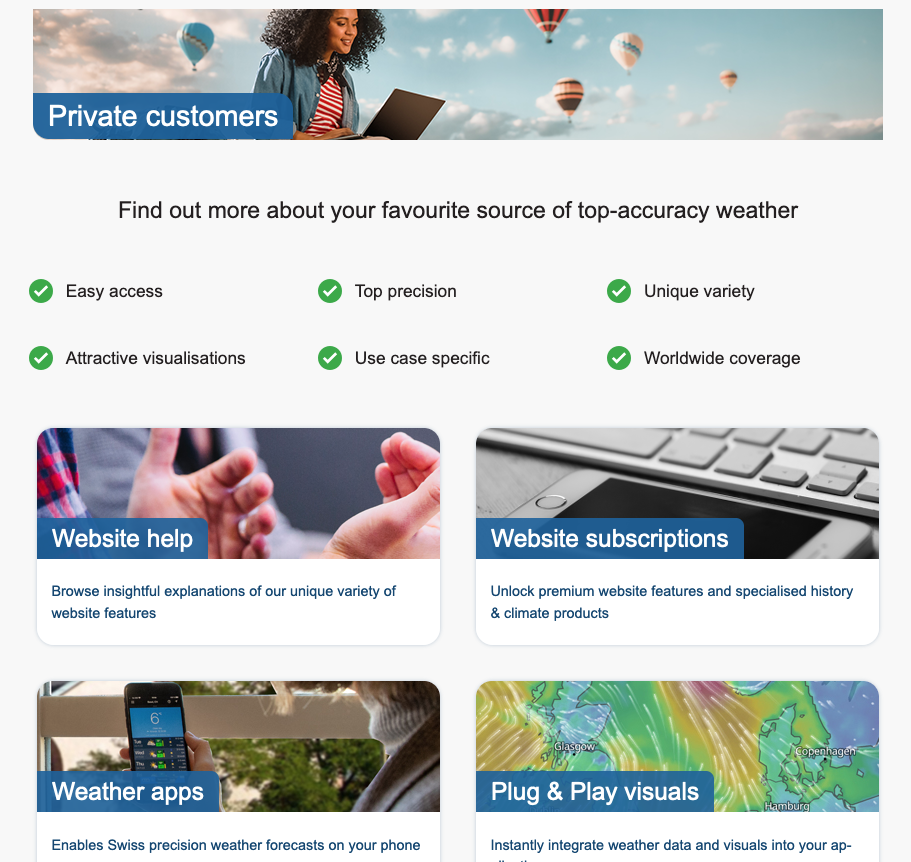
For pilots who need highly accurate and detailed weather data, Meteoblue is a trusted companion. Known for its wide range of weather models and user-friendly interface, Meteoblue is ideal for planning safe and efficient paragliding flights.
- Main Category: Weather & Wind Forecasting
- Other Categories: Thermal & Lift Optimization
- Device Compatibility: iOS, Android
- User Rating: ★★★★☆ (4.6/5)
- Price: Free with premium options
- Free Trial: Yes
Why Meteoblue is a Top Paragliding App
Multiple Forecast Models: Access data from various forecast models like GFS, ECMWF, and ICON. Compare weather scenarios to choose the most accurate forecast for your flying location.
Meteograms and Thermal Forecasts: Benefit from meteograms and thermal lift maps—essential for cross-country flying. They display wind speed, temperature, precipitation, and cloud cover in an easy-to-read format.
Airgram and Sounding Diagrams: Get advanced data, including vertical temperature profiles and wind direction at different altitudes. This is valuable for understanding flight conditions at various heights.
Real-Time Data: Receive real-time weather updates, making it particularly useful for making last-minute flight decisions.
What Pilots Like About Meteoblue
- Highly Accurate Weather Models: Paragliders appreciate the detailed and accurate weather forecasts, which are essential for planning and executing safe flights.
- Thermal Lift Maps: Cross-country pilots benefit from the thermal lift forecasts, helping them identify updrafts and optimize flight paths.
- Wide Data Coverage: The app provides a wealth of weather data, from meteograms to wind speed and thermal conditions, making it a go-to tool for serious paragliders.
Summary of Pilot Reviews
- Premium Features Required: While the free version offers useful data, many advanced features—such as thermal lift forecasts and sounding diagrams—require a premium subscription.
- Complex for Casual Users: Some users find the level of detail overwhelming if they are unfamiliar with interpreting advanced weather models, particularly for casual or beginner pilots.
Why Weather & Wind Forecasting Apps are Essential
Having accurate weather information is crucial for any paraglider. These paragliding apps not only help you plan your flights but also ensure your safety by alerting you to potential risks. Whether you’re into thermal optimization, flight tracking, or simply want to know the best time to fly, apps like Windy.app and Meteoblue have got you covered.
Community & Competition Paragliding Apps
Looking to connect with fellow paragliders worldwide, share your flights, and maybe even engage in some friendly competition? Community & Competition apps are designed just for you! These platforms bring pilots together, fostering a sense of camaraderie and offering opportunities to participate in global or local competitions.
Whether you’re aiming to improve your skills, gain recognition, or simply share your paragliding experiences with a wider audience, these apps help build a supportive and competitive flying community.
More on Paragliding Community – Joining the Paragliding Community: Clubs and Groups in the UK

XContest – Global Competition and Flight Tracking for Paragliders
Ready to take your paragliding to the next level and compete with pilots around the globe? XContest is one of the best paragliding apps for those who love a bit of competition and community engagement. Popular among both competitive and recreational pilots, XContest offers real-time tracking, competition leaderboards, and seamless integration with other paragliding apps.
- Main Category: Community & Competitions
- Other Categories: Flight Tracking & Logging
- Device Compatibility: Android and Web
- User Rating: ★★★★☆ (4.7/5)
- Price: Free with premium options
- Free Trial: Yes
Why XContest is a Popular Paragliding App
Flight Logging: Easily log and track your flights by uploading IGC files for analysis and competition scoring. Keeping all your flight data organized has never been simpler.
Competition Leaderboards: Feel the thrill of competition by comparing your performance with other pilots globally or regionally. Live standings keep you in the loop.
IGC File Support: Integrated with popular flight logging apps like Flyskyhy and XCTrack, making data uploads seamless and hassle-free.
Global Community: Connect with fellow paragliders, share your flight experiences, and learn from others through the XContest platform. It’s all about building connections!
Real-Time Tracking: Track flights live and monitor the positions of others during competitions. Stay engaged and informed every step of the way.
What Pilots Like About XContest
- Comprehensive Competition Features: Pilots enjoy participating in both global and local competitions, making XContest a go-to app for competitive flying.
- Strong Community Engagement: The platform fosters a highly interactive community, allowing pilots to share insights and flight data.
- App Integration: Easily integrates with apps like Flyskyhy and XCTrack, streamlining the upload process and enhancing your overall experience.
Tips from Paragliding Users
- Geared Toward Competition: Some pilots feel the app is more suited for competitive flying, with fewer features for casual pilots. If you’re just looking to log flights without the competitive aspect, this might be something to consider.
- Premium Features: While the basic features are free, advanced tools require a premium subscription, which may not appeal to all users.
WeGlide – Paragliding Flight Analysis and Social Engagement
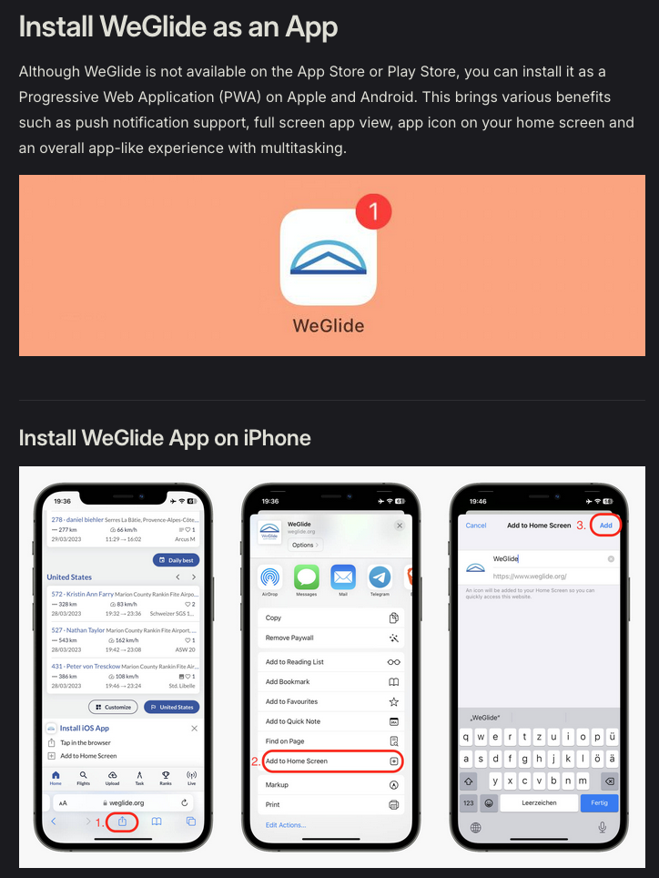
If you’re searching for an app that combines in-depth flight analysis with a vibrant social network, WeGlide is a top contender among paragliding apps. Popular with both competitive and recreational pilots, WeGlide offers real-time flight data, community engagement, and powerful tools to help you improve your performance.
- Main Category: Community & Competitions
- Other Categories: Flight Tracking & Logging, Thermal & Lift Optimization
- Device Compatibility: iOS, Android, and Web
- User Rating: ★★★★☆ (4.7/5)
- Price: Free with premium subscription options
- Free Trial: Yes
Why WeGlide is a Popular Paragliding App
Real-Time Flight Data: Get real-time thermal maps and flight tracking for strategic in-flight decision-making. Optimize your flights like never before!
Social Engagement: Share your flights, compare results, and follow friends. WeGlide creates a connected community of paragliders, enhancing the social aspect of flying.
Flight Analysis: Dive into 3D and 2D flight analysis tools to evaluate and improve your performance. It’s like having a coach in your pocket!
Speed-to-Fly Analysis: Optimize your flight by analyzing the best speed to fly based on real-time data and conditions.
Offline Support: Download maps and data for offline use, ensuring access even in remote areas. Never let poor connectivity ground your adventures.
WeGlide Main Features
- Real-Time Thermal Tracking: The thermal maps and vertical airspeed data help pilots make in-flight decisions with confidence.
- Flight Sharing: Pilots love the social aspect of sharing flights and engaging with other members of the paragliding community.
- Flight Analysis Tools: The detailed flight analysis, especially the 3D flight replay, is appreciated for helping pilots refine their skills.
Summary of App Reviews
- Premium Subscription Required: Some of the more advanced features, like detailed analysis and thermal tracking, are locked behind a paywall.
- Primarily Competition Focused: While it’s great for competitive pilots, casual paragliders might find the platform’s focus on competitions less appealing.
Air Tribune – Paragliding Competition and Live Tracking
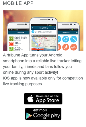
Passionate about paragliding competitions and want an app that covers all aspects—from organizing to live tracking? Air Tribune is the way to go. Widely used by competitive pilots, Air Tribune offers real-time flight tracking and event management, providing live updates for both pilots and spectators.
- Main Category: Community & Competitions
- Other Categories: Flight Tracking & Logging, Navigation & Mapping
- Device Compatibility: iOS, Android, and Web
- User Rating: ★★★★☆ (4.4/5)
- Price: Free with premium options for organizers
- Free Trial: Yes
Why Air Tribune is a Top Paragliding App
Live Tracking: Provides real-time GPS tracking during competitions, making it easy for spectators to follow flights and for organizers to manage events.
Event Management: Organizers can set up and manage competitions, track participants, and provide updates in real time. It’s an all-in-one solution for event planning.
Interactive Map: Displays the positions of all pilots during a competition, showing flight paths and standings in real time.
Flight Recording: Logs all flight data for post-competition review or sharing with others. Great for analyzing performance and sharing your achievements.
Results and Standings: Displays live competition results and standings, keeping pilots and organizers updated during events.
What Pilots and Organizers Love About Air Tribune
- Real-Time Tracking: Pilots and spectators appreciate the live GPS tracking during competitions, enhancing the experience and keeping everyone updated.
- Comprehensive Event Management: Organizers love the app’s tools for handling registrations, tracking participants, and updating results.
- Flight Statistics: Detailed flight data is available for post-flight review, making it great for improving performance and sharing logs.
Tips from Paraglider Reviews
- Geared Toward Competitions: Primarily focused on competitive flying, so casual or recreational paragliders may find limited use for it.
- Premium Organizer Features: Some of the advanced event management tools require a paid subscription, which can be a downside for smaller events.
Why Community & Competition Apps Matter
These paragliding apps aren’t just about flying; they’re about connecting with others who share your passion. Whether you’re looking to compete on a global stage, improve your skills through detailed analysis, or simply share your flights with friends, these apps provide the platform to do it.
They build a supportive and competitive community that can enhance your paragliding experience in ways you might not have imagined.
Read more on Paragliding Competitions in the UK and the World
Safety & Emergency Assistance Apps
When you’re soaring high above the ground, safety isn’t just a priority—it’s a necessity. Safety & Emergency Assistance apps equip paragliders with essential tools to enhance safety during every flight. From real-time location sharing to emergency SOS alerts and first aid guidance, these apps ensure help is just a tap away if you need it.
Some even feature crash detection, automatically sending alerts to your contacts if an incident occurs. Especially when flying solo or exploring remote locations, these apps provide peace of mind, giving you extra security and assistance when you need it most.
More Info on Paragliding Safety – Is Paragliding Safe? A Data-Driven Perspective
MySOS App– Your Lifeline in the Sky
Imagine having an app that can instantly send out an SOS with your exact location and health details. MySOS is a must-have safety app for paragliders, offering critical emergency tools and first aid guidance. It’s designed to ensure that your location and vital information are quickly shared with emergency contacts during unforeseen situations—making it ideal for flights in remote areas.

- Main Category: Safety & Emergency Assistance
- Device Compatibility: iOS and Android
- User Rating: ★★★☆☆ (2.3/5)
- Price: Free
Why MySOS is Essential for Paragliders
SOS Alert System: Quickly sends your location and health details to emergency contacts, providing a crucial safety net.
First Aid Instructions: Offers step-by-step guidance for handling common emergencies like fractures or burns.
Offline Functionality: Access first aid information without an internet connection—perfect for remote flights.
Emergency Contact Storage: Keep your emergency contacts readily accessible for fast responses when needed.
What Pilots Say About MySOS Features
- Fast SOS Alerts: Pilots value the quick, easy-to-use alert system, which provides immediate location updates to emergency contacts.
- Offline First Aid Guidance: Helpful for ensuring first aid information is accessible even without internet connectivity.
- User-Friendly Interface: Simple and intuitive design makes it easy to navigate, especially in stressful situations.
Summary of User Reviews
- Limited Advanced Features: Some users wish for more detailed medical information for complex situations.
- User Experience: While offering essential features, the app’s lower user rating suggests room for improvement based on user feedback.
Life360 – Stay Connected and Safe in the Skies
Ever wanted your loved ones to track your flight in real-time? Life360 makes it possible! This popular location-sharing app provides real-time GPS tracking and emergency alerts. For paragliding pilots, it’s a valuable tool for sharing live location with friends, family, or team members—adding an extra layer of safety and peace of mind during flights.

- Main Category: Safety & Emergency Assistance
- Other Categories: Navigation & Mapping
- Device Compatibility: iOS and Android
- User Rating: ★★★★☆ (4.6/5)
- Price: Free with in-app purchases
- Free Trial: Yes
Why Life360 is a Must-Have Paragliding App
Real-Time Location Sharing: Share your live location with designated groups, keeping loved ones updated during your flight.
Emergency SOS Alerts: Sends an alert with your exact location to emergency contacts in case of a crash or hard landing.
Crash Detection: Monitors for sudden stops or impacts, automatically alerting contacts if an accident occurs.
Custom Circles: Create private groups for location sharing—perfect for coordinating with fellow pilots or support teams.
Why Pilots Choose Life360
- Real-Time Tracking: Ensures safety by allowing others to monitor your exact location, especially in remote or unfamiliar areas.
- Crash Detection: The automatic alerts offer peace of mind, particularly for solo pilots.
- User-Friendly Interface: Easy setup and intuitive design minimize distractions, letting you focus on flying.
Pilot’s Tips
- Battery Usage: Continuous GPS tracking can drain your battery faster, so consider carrying a portable charger on longer flights.
- Reliance on Network Coverage: The app requires mobile network connectivity for real-time tracking, which may be limited in very remote locations.
Cairn – Your Safety Companion for Remote Adventures
Planning to explore remote flying sites where cell service is spotty? Cairn is designed to enhance your safety by allowing real-time location sharing, automatic check-ins, and emergency alerts—even when you’re offline. It’s like having a personal safety net that ensures loved ones can track your progress and be alerted if something goes wrong.
- Main Category: Safety & Emergency Assistance
- Other Categories: Navigation & Mapping
- Device Compatibility: iOS and Android
- User Rating: ★★★★☆ (4.7/5)
- Price: Free with premium options
- Free Trial: Yes
Why Cairn is a Great Paragliding App
Location Sharing: Automatically shares your real-time location with emergency contacts, even without cell service.
Check-Ins & Alerts: Set automatic check-ins to notify contacts when you’ve arrived safely or if you’re overdue.
Crowdsourced Cell Coverage Maps: Discover where mobile coverage is available, helping you plan routes with potential service areas.
Offline Maps: Download maps for offline use, ensuring reliable navigation regardless of connectivity.
SOS Alerts: If you miss a scheduled check-in, Cairn automatically sends an SOS alert with your last known location.
Main Cairn App Features
- Real-Time Tracking: Enhances safety by keeping loved ones informed of your location during flights in remote areas.
- Automatic Alerts: Offers peace of mind with scheduled check-ins and overdue notifications.
- Cell Coverage Insights: Helps identify areas with potential signal, useful for planning flights over less-traveled regions.
Tips from Paraglider Users
- Coverage Data Limitations: Relies on user-submitted data for cell coverage, which may be sparse in less-trafficked areas.
- Subscription for Advanced Features: Some premium features like extended tracking and offline maps require a subscription.
Red Cross First Aid App – Your Pocket Lifesaver
When it comes to safety, being prepared for emergencies is crucial, especially in paragliding where situations can change rapidly. The Red Cross First Aid App is a valuable tool that provides instant access to information on how to handle common first aid emergencies. It’s designed to help you act confidently and effectively when every second counts.
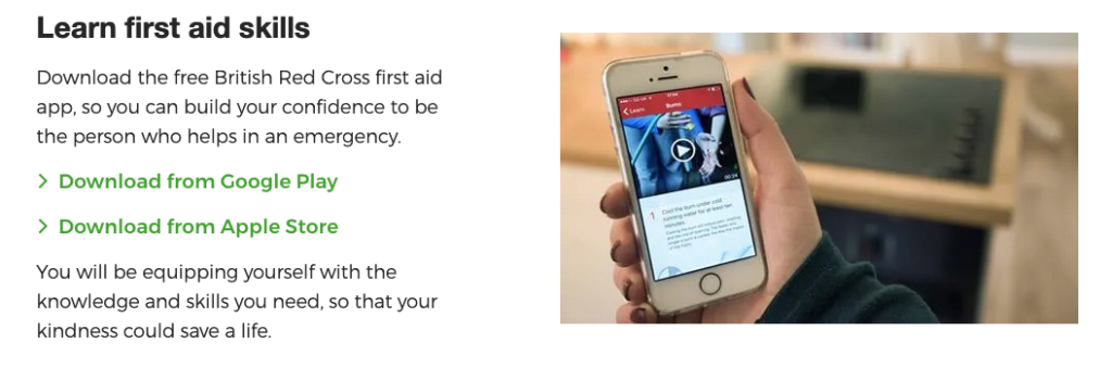
- Main Category: Safety & Emergency Assistance
- Device Compatibility: iOS and Android
- User Rating: ★★★★☆ (Varies by region, generally around 4.5/5)
- Price: Free
- Free Trial: Not Applicable
Why the Red Cross First Aid App is Essential for Paragliders
Comprehensive First Aid Guidance: Offers step-by-step instructions for dealing with a wide range of emergencies, including injuries that could occur during paragliding like fractures, sprains, and head injuries.
Interactive Content: Includes videos, animations, and quizzes to enhance learning and retention of crucial first aid procedures.
Emergency Preparedness: Provides safety tips and checklists to help you prepare for unexpected situations, ensuring you’re ready both on the ground and in the air.
Offline Access: All content is available offline, so you can access vital information even when you’re out of mobile range—perfect for remote flying locations.
Easy Navigation: Designed for quick access in emergencies, allowing you to find the information you need swiftly.
What Pilots Like About the Red Cross First Aid App
- User-Friendly Design: The intuitive layout makes it easy to find first aid procedures quickly, which is crucial when time is of the essence.
- Educational Value: Pilots appreciate the app’s ability to teach and reinforce first aid knowledge, making them better prepared for emergencies.
- Trusted Source: Content provided by the Red Cross ensures that the guidance is reliable and up-to-date with the latest first aid protocols.
- Regular Updates: The app is frequently updated to include new information and adhere to current first aid standards.
Tips from Pilots – Users
- Not a Substitute for Professional Training: While the app is a great resource, it’s recommended to undergo formal first aid training for comprehensive knowledge and certification.
- No Live Emergency Features: Unlike some other safety apps, it doesn’t offer features like SOS alerts or real-time location sharing. Consider combining it with apps like Life360 or Cairn for a more complete safety toolkit.
- Regional Availability: The app may have different versions or availability depending on your country. Ensure you’re downloading the correct version to access localized emergency numbers and procedures.
FANET – Revolutionizing Real-Time Communication for Paragliders
Because it is mentioned few times in the blog, we wanted to explain what FANET is, what it does, how it works and why its important.
While not an app, FANET (Flying Ad-hoc Network) is a game-changing wireless communication network for paragliders, hang gliders, and other free-flight enthusiasts. It allows real-time data exchange between pilots, enhancing safety and connectivity in the air.
Integrated into modern flight instruments like Skytraxx Fanet+, FANET helps you avoid collisions, navigate efficiently, and stay connected without relying on mobile data.
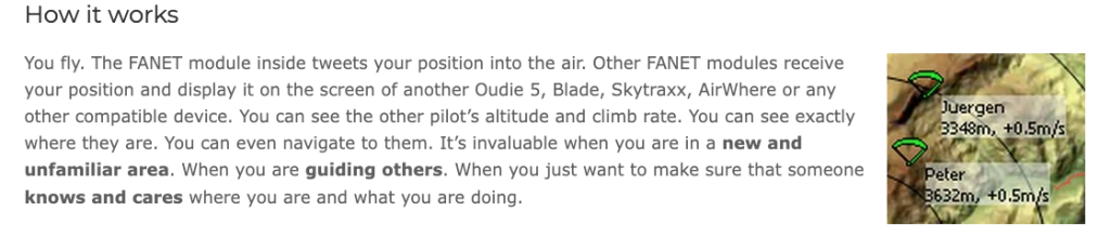
Why FANET is Important for Paragliders
Real-Time Position Sharing: Share your real-time position, altitude, and flight data with nearby pilots, aiding in coordination during group flights or competitions.
Collision Avoidance: Reduces the risk of mid-air collisions by displaying the positions of nearby aircraft and gliders, especially when integrated with FLARM systems.
Weather and Airspace Information: In some setups, FANET can share local weather data and airspace alerts, helping you make informed decisions.
Live Tracking: Allows ground crews, friends, or family to follow your location in real-time, even in areas without mobile network coverage.
How Does FANET Work?
FANET operates as a mesh network without the need for a central server or internet connection. Each pilot’s device acts as a node, sharing information with other nearby devices in real-time. This is particularly useful in areas with no cell coverage, ensuring continuous communication and safety features.
Devices That Use FANET
- Skytraxx Fanet+
- Flymaster
- Syride SYS’Nav V3
What Pilots Use FANET
- Real-Time Communication and Tracking: Enhances situational awareness and safety by displaying other pilots’ locations.
- No Reliance on Mobile Networks: Works seamlessly even in remote areas without internet or cell service.
- Improved Safety: Assists in collision avoidance and efficient navigation during flights.
Tips from Experienced Pilots
- Requires Compatible Devices: You’ll need a flight instrument that supports FANET, such as Skytraxx or Flymaster.
- Not Universally Available: Not all flight instruments support FANET, so check compatibility before investing.
Paragliding Apps Frequently Asked Questions (FAQ)
We understand that we’ve given you a lot of information that might be overwhelming. To simplify and summarize it, here is a list of frequently asked questions about paragliding apps.
This FAQ section addresses common queries to help you make informed decisions and get the most out of your paragliding experience. Earlier in the blog, we’ve also included a comparison Table by features, categories, device and more.

1. What are the best paragliding apps for beginners?
Start with user-friendly apps that offer essential features without overwhelming complexity. Here are some top recommendations:
- Flyskyhy Soaring App (iOS): Offers real-time flight data and easy integration with variometers, making it accessible for novices.
- TheFlightVario App (Android): Transforms your smartphone into a basic flight instrument with customizable displays.
- AllTrails (iOS and Android): Great for hike-and-fly adventures, providing detailed trail maps and user reviews.
- Windy.app (iOS and Android): Provides accurate weather and wind forecasts, crucial for planning safe flights.
2. Are there free paragliding apps available, and are they effective?
Yes, several high-quality paragliding apps are available for free and offer a range of useful features, here are a few:
- XCTrack (Android): A comprehensive app for flight tracking, navigation, and competitions, free to use with donations encouraged.
- Gaggle Flight Recorder App (iOS and Android): Offers GPS flight tracking and flight log sharing in its free version.
- FlyMe (Android): Provides real-time flight data, offline maps, and thermal tracking with free basic features.
- Windy.app (iOS and Android): Free version includes essential weather data; premium features are optional.
While free apps are effective for many pilots, premium versions or paid apps often offer advanced features like detailed thermal maps, offline capabilities, and enhanced customization.
3. Do I need an internet connection to use these paragliding apps?
Many paragliding apps offer offline functionality, which is crucial when flying in remote areas with limited connectivity:
- Offline Maps: Apps like FlyMe, MapOut, and Gaia GPS allow you to download maps for offline use.
- Real-Time Data: Features like live tracking and weather updates typically require an internet connection.
- Flight Logging: Most apps can record flight data without connectivity and sync when back online.
It’s advisable to check each app’s offline capabilities and download necessary data (maps, waypoints) before heading out.
4. How do these apps enhance safety during paragliding flights?
Safety is paramount in paragliding, and these apps contribute significantly:
- Airspace Awareness: Apps like FlySafe and Air Navigation Pro alert you to restricted or controlled airspaces.
- Emergency SOS Alerts: MySOS and Life360 can send your location to emergency contacts in case of an incident.
- Real-Time Tracking: Wingman and Cairn allow others to monitor your flight live, aiding in quick response if needed.
- Weather Forecasting: Windy.app and Meteoblue provide accurate weather data to avoid hazardous conditions.
5. Can I use these apps for both paragliding and hang gliding?
Absolutely! Many of these apps are designed for various free-flight activities:
- XCSoar and Flyskyhy cater to both paragliders and hang gliders.
- Air Navigation Pro and XCTrack are versatile and widely used across different air sports.
- FANET technology enhances safety for all types of gliders by enabling real-time communication.
Always check the app’s description to ensure it meets the specific needs of your flight activity.
6. How accurate are the weather and thermal forecasts provided by these apps?
The accuracy of weather and thermal forecasts is generally high but can vary based on:
- Data Sources: Apps like Windy.app and Meteoblue aggregate data from multiple reputable models (GFS, ECMWF).
- Local Conditions: Microclimates can affect accuracy; always consider local knowledge and observations.
- App Updates: Regularly updating apps ensures you have the latest forecasting technology.
While these apps are valuable tools, pilots should use them in conjunction with other resources and personal judgment.
7. Are these paragliding apps compatible with both iOS and Android devices?
Compatibility varies by app:
- iOS Only: Flyskyhy Soaring App, MapOut.
- Android Only: XCTrack, FlyMe, onX Maps, xC Analytics.
- Both iOS and Android: Windy.app, Meteoblue, Gaggle, Wingman, Air Navigation Pro.
Be sure to check the device compatibility listed in each app’s description to ensure it works with your smartphone or tablet.
8. Do these paragliding apps require additional hardware or devices to function properly?
Most apps operate using your smartphone’s built-in sensors, but additional hardware can enhance functionality:
- External Variometers: Apps like Flyskyhy and XCTrack can integrate with devices like XC Tracer for more accurate data.
- FANET Devices: To use FANET technology, you’ll need compatible flight instruments like Skytraxx Fanet+.
- GPS Sensors: Some pilots use external GPS devices for improved location accuracy.
While not mandatory, these accessories can provide more precise data and better performance.

9. How to choose the best paragliding app for my needs?
Consider the following factors:
- Skill Level: Beginners might prefer apps with user-friendly interfaces like TheFlightVario or AllTrails.
- Flight Goals: For cross-country flying, apps with advanced navigation and thermal optimization like XCTrack are beneficial.
- Device Compatibility: Ensure the app is available on your operating system (iOS or Android).
- Features Needed: Prioritize apps that offer the functionalities you need—be it weather forecasting, flight logging, or community engagement.
- Budget: Decide if you’re willing to pay for premium features or prefer free apps.
Reading user reviews and trying out free versions can also help you make an informed decision.
10. Are there apps specifically for planning hike-and-fly paragliding routes?
Yes, several apps cater to hike-and-fly enthusiasts:
- onX Maps (Android): Offers detailed 3D terrain mapping and offline access.
- MapOut (iOS): Provides high-quality maps and elevation profiles.
- AllTrails (iOS and Android): Features an extensive database of trails with user reviews.
- Gaia GPS (iOS and Android): Known for precise tools and offline capabilities.
These apps help you plan routes that combine hiking with paragliding, offering detailed trail maps and elevation data.
11. How do paragliding community and competition apps enhance my paragliding experience?
Community and competition apps offer several benefits:
- Flight Sharing: Share your flights and experiences with a global community via WeGlide or XContest.
- Competitions: Participate in local or global competitions to challenge yourself and improve your skills.
- Learning Opportunities: Engage with other pilots, exchange tips, and learn from their experiences.
- Live Tracking: Apps like Air Tribune allow spectators to follow competitions in real-time.
These platforms foster camaraderie and provide opportunities for recognition and skill development.
12. What precautions should I take when relying on these apps during paragliding flights?
While these apps are valuable tools, consider the following precautions:
- Battery Management: High GPS usage can drain your battery; carry a portable charger.
- Backup Navigation: Don’t rely solely on apps; always have a physical map or alternative navigation method.
- Regular Updates: Keep your apps updated to benefit from the latest features and security patches.
- Verify Data: Cross-reference critical information like weather forecasts and airspace restrictions from multiple sources.
- Emergency Plans: Know how to use the app’s emergency features before you need them.
13. Can I use these apps internationally when traveling for paragliding?
Yes, many apps offer global coverage:
- Weather Apps: Windy.app and Meteoblue provide weather data for locations worldwide.
- Navigation Apps: Air Navigation Pro and XCSoar include international airspace maps.
- Community Platforms: XContest and WeGlide connect pilots globally.
However, always check for regional restrictions or the need to download specific maps and data for offline use before traveling.
14. Which apps connect with wearable devices like smartwatches?
Yes, some apps offer integration with wearables:
- Flyskyhy Soaring App: Extends functionality to the Apple Watch, allowing you to view basic flight data on your wrist.
- Life360: Offers notifications and tracking that can sync with smartwatches for quick glances.
This feature adds convenience by allowing you to access essential information without handling your phone during flight.
15. How do thermal and lift optimization apps benefit my paragliding flights?
These apps help you:
- Locate Thermals: Identify areas with rising air to extend your flight duration.
- Plan Efficient Routes: Use thermal maps to optimize cross-country flights.
- Enhance Safety: Avoid areas with sink or turbulent air conditions.
- Improve Skills: Analyzing thermal patterns can help you become a more proficient pilot.
Apps like Paraglidable and XC Therm specialize in providing thermal forecasts and real-time data.

16. Which paragliding app offers the most comprehensive, all-in-one features?
If you’re looking for an app that combines multiple functionalities into one platform, XCTrack (Android) is widely regarded as one of the most inclusive paragliding apps available. It offers:
- Flight Tracking & Logging: Real-time flight data with customizable dashboards.
- Navigation & Mapping: Offline maps, route planning, and waypoint management.
- Thermal & Lift Optimization: Real-time thermal tracking to maximize airtime.
- Competition Tools: Features like waypoint management and automatic task scoring.
- Community Engagement: Integration with platforms like XContest for sharing and comparing flights.
- Weather Forecasting: Basic weather data to aid in flight planning.
For iOS users, Flyskyhy Soaring App is a close equivalent, offering a range of features including real-time flight data, airspace warnings, flight logging, weather and thermal assistance.
17. What is an IGC file export, and why is it important for paragliding pilots?
IGC files are the international standard file format for recording flight data in gliding and paragliding. Here’s why they are important:
- Flight Verification: IGC files contain authenticated GPS data used to verify flight claims in competitions and record attempts.
- Detailed Analysis: They store comprehensive flight information like altitude, speed, and position, allowing pilots to analyze their performance in depth.
- Sharing and Community Engagement: Pilots can share IGC files on platforms like XContest or WeGlide to compare flights and engage with the community.
- Compliance with Regulations: In some cases, IGC files are required to demonstrate compliance with airspace regulations or for insurance purposes.
Apps like Gaggle Flight Recorder, XCTrack, and Flyskyhy support IGC file export, making it easy for pilots to log and share their flights.
18. Which paragliding apps are best for advanced paragliding pilots?
Advanced pilots often require apps with sophisticated features for detailed analysis, competition, and advanced navigation. Top recommendations include:
- XCTrack (Android): Offers advanced navigation, thermal optimization, and competition tools like automatic task scoring.
- XCSoar (Android, Windows): An open-source app with extensive customization options, advanced cross-country navigation, and thermal assistance.
- xC Analytics (Android): Provides in-depth flight analysis with over 63 unique flight statistics, ideal for pilots looking to refine their performance.
- Flyskyhy Soaring App (iOS): Features detailed flight data, airspace warnings, and integration with external variometers for precise information.
These apps cater to the needs of seasoned pilots by offering advanced functionalities that go beyond basic flight tracking.
19. Which app is best for cross-country paragliding?
For cross-country (XC) paragliding, where long-distance flights and efficient navigation are crucial, XCTrack (Android) stands out as the top choice. Here’s why:
- Advanced Navigation Tools: Offers real-time GPS navigation with offline maps and customizable waypoints.
- Thermal Optimization: Real-time thermal tracking helps pilots find and utilize lift effectively.
- Competition Features: Includes waypoint management and integration with XContest for competitive XC flying.
- Customizable Dashboards: Tailor the interface to display critical data like glide ratio, wind speed, and thermal gain.
For iOS users, Flyskyhy Soaring App is an excellent alternative, providing comprehensive tools for XC flying, including thermal assistance and detailed flight logging.
Note: The best app for you may depend on your specific needs, device compatibility, and personal preferences. It’s often helpful to try out a few different apps to see which one aligns best with your flying style and requirements.
19. Can I use multiple paragliding apps together, and which apps can be effectively combined?
Yes, you can and often should use multiple paragliding apps in combination to enhance your flying experience. Different apps specialize in various aspects of paragliding, and combining them allows you to leverage the strengths of each. Here are some effective ways to combine apps:
- Flight Tracking and Weather Forecasting:
- Combine: XCTrack (Android) or Flyskyhy Soaring App (iOS) with Windy.app or Meteoblue.
- Benefit: Use XCTrack or Flyskyhy for real-time flight tracking and logging, and pair it with Windy.app or Meteoblue for accurate weather and wind forecasts. This combination helps you plan your flight and make real-time adjustments based on weather conditions.
- Navigation and Safety:
- Combine: Air Navigation Pro with Life360 or Cairn.
- Benefit: Air Navigation Pro provides advanced navigation and airspace awareness, while Life360 or Cairn adds real-time location sharing and emergency alerts. This ensures safe navigation while keeping your loved ones informed of your location.
- Thermal Optimization and Flight Analysis:
- Combine: Paraglidable or XC Therm with xC Analytics.
- Benefit: Use Paraglidable or XC Therm for thermal and lift optimization to find the best lift zones, and pair it with xC Analytics for in-depth flight performance analysis. This helps you maximize airtime and refine your flying skills.
- Community Engagement and Competitions:
- Combine: XCTrack or Flyskyhy with XContest or WeGlide.
- Benefit: Track your flights using XCTrack or Flyskyhy and upload your flight logs to XContest or WeGlide to participate in competitions and engage with the paragliding community.
- Hike-and-Fly Planning and Flight Tracking:
- Combine: AllTrails or Gaia GPS with FlyMe or TheFlightVario.
- Benefit: Plan your hiking route to the launch site using AllTrails or Gaia GPS, then use FlyMe or TheFlightVario to track your flight. This ensures a seamless experience from hike to flight.
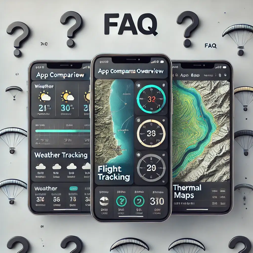
Tips for Combining Paragliding Apps
By thoughtfully combining apps, you can create a personalized toolkit that covers all aspects of your paragliding experience. From pre-flight planning and in-flight navigation to post-flight analysis and community interaction.
- Check Device Compatibility:
- Ensure that the apps you wish to use simultaneously are compatible with your device’s operating system and hardware capabilities.
- Manage Battery Usage:
- Running multiple apps can drain your battery more quickly. Carry a portable charger or battery pack during long flights.
- Customize Notifications:
- Adjust notification settings to prevent overload and ensure you receive only the most critical alerts during flight.
- Data Integration:
- Some apps allow for data export/import (e.g., IGC files), enabling you to transfer flight logs between apps for comprehensive analysis.
- Test Before Flight:
- Familiarize yourself with how the apps work together before relying on them during a flight. This helps prevent any unexpected issues when you’re airborne.
Note: Always prioritize safety when using multiple apps. Ensure that interacting with your devices does not distract you during critical phases of your flight.
Safe Travels and Happy Soaring!
As we cover the top paragliding apps across various categories, it’s clear that the combination of technology and adventure sports is opening opportunities for pilots worldwide. These apps are more than just tools; they’re companions that enhance every part of your flying experience. From flight tracking and advanced navigation to fostering community connections and ensuring your safety in the skies.
By integrating these apps into your paragliding routine, you not only improve your skills but also join a global community of enthusiasts who share your passion. If you’re navigating thermals with precision, discovering new launch sites, or staying informed about weather conditions, the right app can make all the difference.
Equip yourself with these top paragliding apps and soar to new heights – both literally and figuratively. Embrace the technology that keeps you connected, informed, and safe, and let it take your paragliding adventures to new levels.
Clear Skies and Happy Soaring!
Check out adventuro Paragliding for the latest Paragliding Courses, Lessons and Activities near you!