
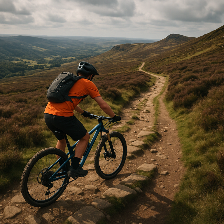
Mountain Biking in the Peak District: A Guide for Expert Riders
The Peak District offers some of Britain’s finest mountain biking, with a mix of rugged natural trails and a few man-made tracks on its fringes. Expert riders will find plenty of challenges on the Peak’s ancient packhorse routes, rocky descents, and moorland singletracks. While there are no official trail centres within the national park itself, several purpose-built trails just outside cater to mountain bikers. Below is a detailed guide to the best locations – from iconic natural descents like Jacob’s Ladder to the flowy turns of Lady Canning’s plantation – with all the practical info you need. Each trail entry includes difficulty, terrain, bike suitability, route length, local bike hire, public transport from Manchester, and a note on the area’s history and landscape.
Natural Trails (Wild Terrain)
The Peak District’s natural trails mostly follow bridleways and old packhorse routes across the hills. Expect rocky surfaces, steep gradients, and technical sections that will test even skilled riders. The Dark Peak (northern Peak District) is dominated by gritstone rocks, peat moors, and “classic” rough descents, while the White Peak (southern area) features limestone trails and dales. These routes are generally unsurfaced (no tarmac, except occasional links) – great for e-MTBs, but hybrids will only cope on the gentler ones. Be prepared with tools and maps; these rides often venture into remote areas with unpredictable weather.
Jacob’s Ladder & Edale Valley (Dark Peak, Derbyshire)
Jacob’s Ladder is an iconic Peak District descent that drops from the Kinder Scout plateau into Edale. It’s often tackled as part of a challenging loop from Edale village, including steep climbs and thrilling rocky descents. This trail has stunning views and punishing terrain in equal measure.
Technical Difficulty: Advanced (equivalent to a difficult Black route). The descent is very steep and rocky with large stone steps, demanding expert bike handling.
Terrain: Rocky paved packhorse steps, loose rock gardens, and some boggy moorland sections on the loop. The Ladder itself is a rough stone staircase of old gritstone slabs. Expect “punishing rocks” with a few smoother flowy sections in between.
Suitability (e-MTB/Hybrid): E-MTBs are suitable – the electric assist helps on the brutal climb/push up, and they can handle the rocky descent (ensure your e-bike’s weight doesn’t overwhelm your brakes on the long drop). Not recommended for hybrids – there is no tarmac on the main route, and the rocky steps would be impossible on a hybrid. (Hybrids could enjoy the easier valley bottom tracks, but not the Ladder itself.)
Route Length: The classic loop including Jacob’s Ladder, Rushup Edge, and Roych Clough is about 18–20 miles (29–32 km) with ~1000 m of ascent. It’s a full-day ride for most, or a very strenuous half-day for fast riders. Shorter options (e.g. an up-and-back to the top of the Ladder) are possible if time is limited.
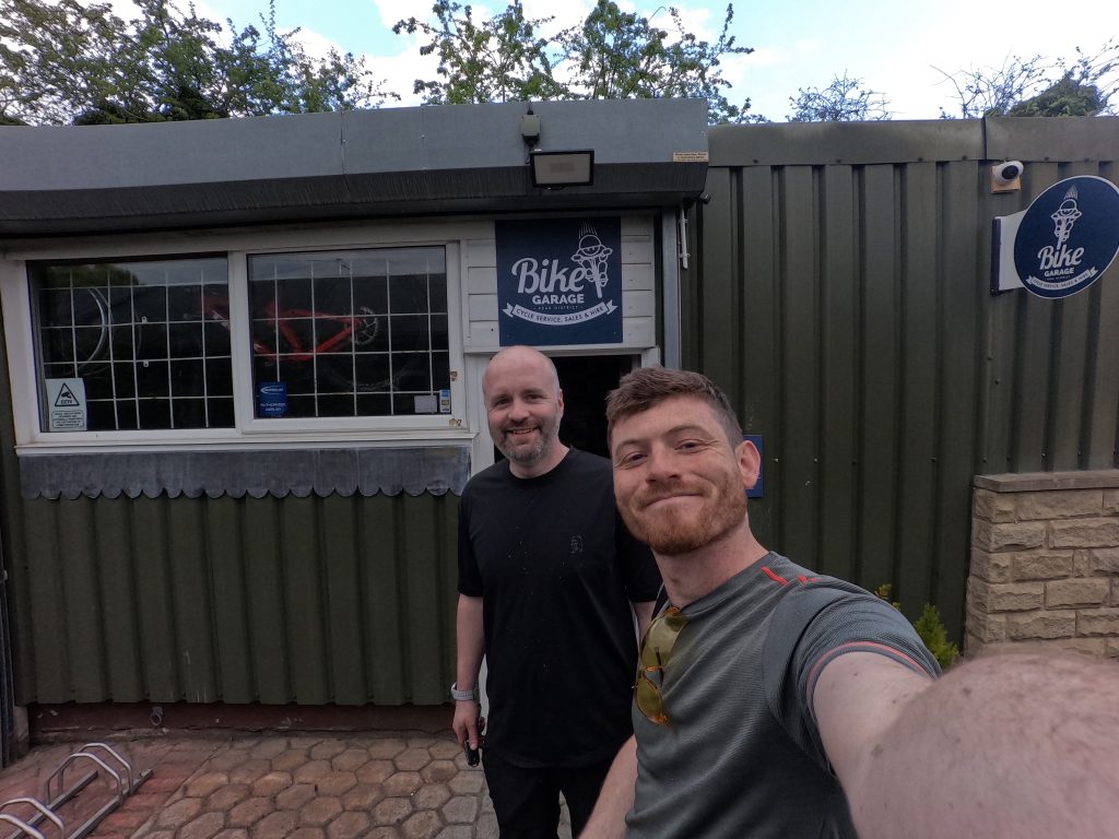
Bike Hire: No bike hire in tiny Edale village itself. Nearest is Bike Garage in Bamford/Hope Valley, ~6 miles away, which hires quality MTBs and e-MTBs. They can offer route advice for Jacob’s Ladder and or guided rides.
Public Transport (from Manchester): Excellent – take the train from Manchester Piccadilly to Edale (Hope Valley Line, ~45 minutes). Edale station is right in the village, so you can ride out on the Pennine Way bridleway towards Jacob’s Ladder. (The Pennine Way leads you to the base of the ascent.) Return by train from Edale. Alternative: Train to Bamford for bike hire, then ride or catch the Hope Valley Explorer bus into Edale.
Local Highlights: Edale is famed as the start of the Pennine Way (Britain’s first long-distance trail) and was a focal point of the 1932 Mass Trespass on Kinder Scout, which led to greater public access to these moors. As you climb Jacob’s Ladder you’ll cross a 17th-century packhorse bridge over the River Noe at the valley bottom – a reminder of the route’s original purpose as a packhorse highway. The trail’s name comes from a local farm labourer, Jacob, who built the stone steps to improve the path. The surrounding landscape is dominated by Kinder Scout, the Peak District’s highest gritstone plateau (notice the dark peat and gritstone that give the “Dark Peak” its name). From the top of the Ladder you get sweeping views back down into Edale Valley and across to the Great Ridge (Mam Tor to Lose Hill). The area has a rich peatland ecology – if you venture onto the moor top, you’ll see weathered gritstone outcrops and perhaps hear grouse chuckling. At ride’s end, Edale has two classic pubs (The Old Nag’s Head and The Rambler Inn) where you can celebrate conquering one of the Peak District’s toughest trails.
Jacob’s Ladder drops from the Kinder Scout plateau into Edale. This steep old packhorse route is now a famous rocky challenge for mountain bikers.
Ladybower & Upper Derwent – The Reservoir Loop (Dark Peak, Derbyshire)
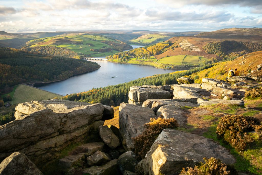
Overview: The Upper Derwent Valley, with its trio of reservoirs (Ladybower, Derwent, Howden), is Peak District mountain biking heaven, offering several interconnected trails. A popular challenge is the Ladybower Loop, a 22-mile circuit around Ladybower Reservoir. Within this area are legendary segments like the Cut Gate Path and the Hagg Farm descent (“the Beast”), which have near-mythical status among UK riders. Expect a mix of forest singletrack, moorland paths, and lakeside tracks – all set against stunning moorland and water scenery.
Technical Difficulty: Intermediate to Advanced. The full Ladybower Loop is long and has technical sections (grade Red with some Black bits). Cut Gate is a very technical moorland trail – definitely advanced. Hagg Farm descent is a fast red-grade downhill: “not technical by any means, but… a real test of mettle“. Overall, strong intermediates can attempt it, but certain sections (rock gardens, steep drops) will challenge experts too.
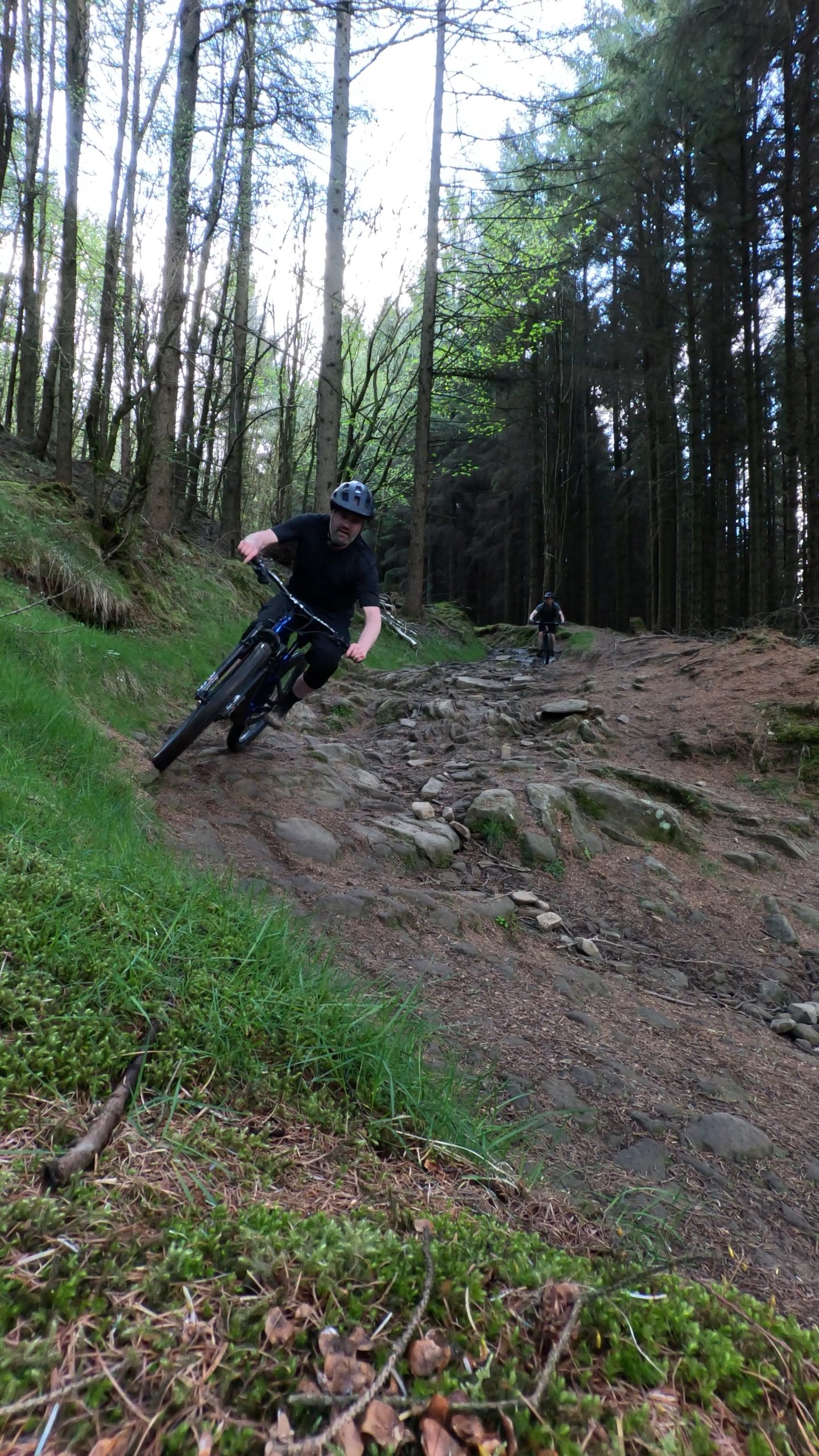
Terrain: Highly varied. You’ll ride gritstone singletrack, rocky descents, loose chutes, and hardpack forest trails, plus some linking fire roads. Cut Gate features rocky slabs and boggy peat sections (notorious in wet seasons, though recent trail work has improved the boggiest “Bog of Doom” stretches). The Hagg Farm descent (off Lockerbrook) starts with bermed hairpin turns, water bars, and rock gardens, providing a “super quick” run if you have the skill and guts. Lower down, it narrows into a rocky gully. Along the reservoir shore, the paths are easier hardpack or gravel. There’s minimal tarmac aside from dam crossings or a short road to connect sections.
Suitability (e-MTB/Hybrid): E-MTBs are ideal here – the long climbs (e.g. up to Cut Gate or onto Derwent Edge) are more manageable with assist, and you’ll still enjoy the descents. Hybrids are not suitable for most of this loop. While parts of the reservoir-side trail are smooth enough, key sections (Cut Gate, Hagg Farm, etc.) are rough and steep. If a hybrid rider wants to join, they could stick to the flat reservoir track (a scenic family-friendly path) and skip the off-road detours – but that misses the real fun. For a hybrid-friendly off-road route in this area, consider the old railway bed section on the east side of Ladybower or the Monsal Trail (White Peak) instead.
Route Length: The Ladybower Loop is about 22 miles (35 km) – plan a full day with stops. Cut Gate as an out-and-back from Ladybower adds ~15 miles extra (the Cut Gate trail itself is ~9 miles one-way), usually done as part of a full-day ride or split into a separate ride. Shorter loops: you can do a half-day 10–15 km loop using just the reservoir and one descent (for example, climb via the access road and do the Hagg Farm downhill and back along the lake).
Bike Hire: Derwent Cycle Hire Centre at Fairholmes (near Derwent Reservoir) offers mountain bikes and e-bikes for hire, but these are more for casual riders on the easy reservoir paths. For high-end MTBs, use Bike Garage (Hope Valley) as mentioned, or True North Adventures @ Bike & Boot (Hope Valley) which hires premium Mondraker e-MTBs. If you’re staying in Sheffield, some shops there rent MTBs as well.
Public Transport: From Manchester, take a train to Bamford station (~50 minutes). From Bamford, it’s a 3-mile ride or taxi to Ladybower Reservoir at the visitor centre (Fairholmes). On summer weekends, the 819 bus or Peak Park shuttle runs from Bamford or Sheffield to Fairholmes. If doing Cut Gate northbound, you could take a train to Penistone (via Huddersfield) then bike ~8 miles to Langsett, but that’s a convoluted journey. Easiest: train to Bamford, ride to the loop start.
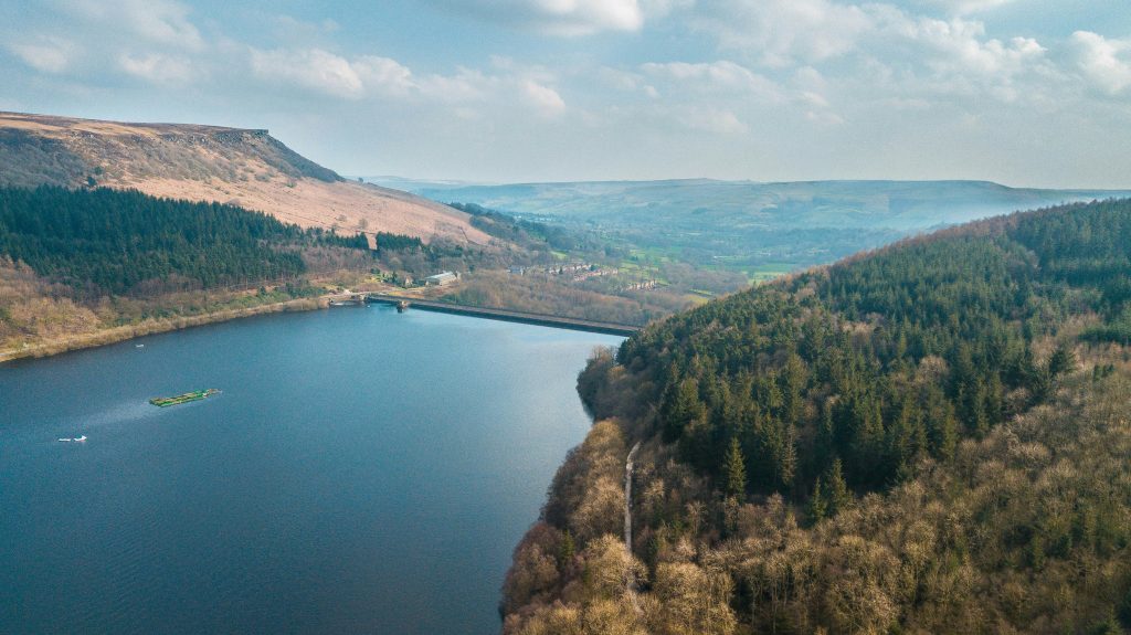
Local Highlights: The Derwent Valley is steeped in history. Derwent and Howden Dams were used by the RAF “Dambusters” squadron for practice runs in WWII – there’s a museum at Derwent Dam. Beneath Ladybower’s waters lie the drowned villages of Derwent and Ashopton, submerged when the reservoir was built in the 1940s (in droughts, the old church spire has even re-emerged). As you ride, you’ll notice the Derwent Edge skyline to the east – gritstone tors like the Salt Cellar and Wheel Stones dot the moor.
If you tackle Cut Gate, you’re riding a famous old packhorse route across the moors. This trail was historically a link between Ladybower and the villages to the north; today it’s known as one of the UK’s best (and boggiest) natural trails. The landscape here is wild and remote – expect curlew calls on the moor in spring and excellent views over the Upper Derwent wilderness. At the end of your ride, you can refresh at the Ladybower Inn (a pub with rooms on the A57) or the Yorkshire Bridge Inn near Bamford – both popular with bikers and hikers.
Stanage Edge & Hope Cross Loop (Dark Peak, Derbyshire)
Overview: Stanage Edge offers an absolutely classic Peak District ride, combining a tough climb with a “fast and very, very rocky descent” down an ancient causeway. This gritstone escarpment north of Hathersage is famous for rock climbing, and luckily for us, a rough bridleway (Long Causeway) runs right along it. A typical loop might start near Ladybower or Hathersage, climb up to Stanage Pole, descend the Stanage Causeway, then return via Hope Cross or other bridleways in the Hope Valley. Expect arm-pumping rock gardens and huge views. (There are also alternative lines like the technical Stanage Plantation singletrack for those who want an extra challenge.)
Technical Difficulty: Advanced (Black). The Stanage Causeway descent is extremely rough – huge embedded rocks and slabs require expert line choice and strong suspension. There are no man-made jumps, but nature has plenty of drops! The loop also involves long climbs and navigation. Less experienced riders can bypass the gnarliest bits or walk sections, but to ride it clean you should be expert.
Terrain: The approach to Stanage often involves some easy track or road, but once on the bridleway it gets interesting. Gritstone paving slabs lead you up to Stanage Pole (an old waymarker on the ridge). From there, the Long Causeway turns into a wide double-track dropping off Stanage Edge. This descent starts fast and progressively gets rougher – it’s essentially a dried-up rocky stream bed in places. Riders face continuous rock steps, loose stones, and occasional ruts. It’s fast and very rocky down the main line. An alternate bridleway through Stanage Plantation offers a slower, twisty route with technical rooty sections among the trees.
After Stanage, many loops include the Hope Cross area: that entails a climb and another descent (the Roman Road towards Hope or the Devil’s Elbow trail). These are also rocky but slightly less intense than Stanage’s main drop. Be ready for some mud if it’s wet, especially on connecting bridleways and in the valleys.
Suitability (e-MTB/Hybrid): E-MTB: Yes, it will help on the long ascents (like up from Ladybower or Hathersage). On the rocky descent, an e-MTB’s extra weight means you’ll need to be cautious, but a capable e-enduro bike will handle it. Hybrids: No way. There’s virtually no tarmac except a short road ride in, and the causeway rocks would destroy a hybrid bike (and its rider’s wrists!). Even the easier plantation trail is far beyond a hybrid’s capacity. Stick to the valley roads or easier bridleways on a hybrid.
Route Length: A Stanage loop can be tailored. A popular circuit from Ladybower/Hope Valley taking in Stanage and Hope Cross is around 18–25 miles (29–40 km) depending on start point and exact route. This is a solid full day’s ride with considerable climbing (~800–1000 m). If starting closer (like from Upper Burbage parking), you can make it a shorter 8–12 mile loop – still a half-day due to the slow going on technical sections.
Bike Hire: James at the Bike Garage (Hope Valley) is convenient for this area as well – they’re only a few miles from the base of Stanage and can provide full-suspension bikes. Also, Hathersage (the nearest village to Stanage) has an outdoor shop culture but no dedicated hire shop; however, Sheffield (a short train ride away) has shops where you could rent a bike if needed.
Public Transport: Take a train from Manchester to Hathersage (~55 min) or Hope (50 min). From Hathersage station it’s about 3 miles uphill on a minor road to the Stanage Edge trailhead at Hollin Bank or Burbage Bridge. From Hope station, it’s a longer climb via Aston/Thornhill to Stanage (a route like the one from Ladybower side). Alternatively, a bus (272) from Sheffield stops at Fox House Inn or Hooks Carr (near Stanage/Burbage) – if coming from Manchester you’d go via Sheffield. Using public transport, a common approach is train to Hope, ride a loop (Hope -> climb Shatton or Brough Lane -> Stanage descent -> Hope). Note: Finishing in Hope/Hathersage is convenient for train return.
Local Highlights: Stanage Edge is an impressive gritstone escarpment ~4 miles long, and as you ride you’re literally following in historic footsteps – the Long Causeway is an old packhorse route (and later a turnpike) that once linked Sheffield to Chapel-en-le-Frith. Remnants of stone pitching can be seen on the upper section. At the top by Stanage Pole, you straddle the boundary of Yorkshire and Derbyshire (take a photo at the pole – it’s a local landmark).
The edge itself is famous for rock climbing; don’t be surprised to see climbers scaling the crags as you pass. Keep an eye out for abandoned millstones near the trail (huge stone discs) – these were left decades ago when the demand for millstones dropped, and now they’re an iconic feature of the Peak landscape. After bombing down the causeway, you enter the Hope Valley, an area of verdant fields surrounded by high moors. The name “Hope Cross” comes from a medieval wayside cross that marked the junction of old paths – you might pass it if your route goes by (it’s just a replica now, the original is in a museum). For scenery, it’s hard to top Stanage: you get panoramic views of Win Hill, Lose Hill, and the Edale skyline. It’s truly “gritstone country” at its best.
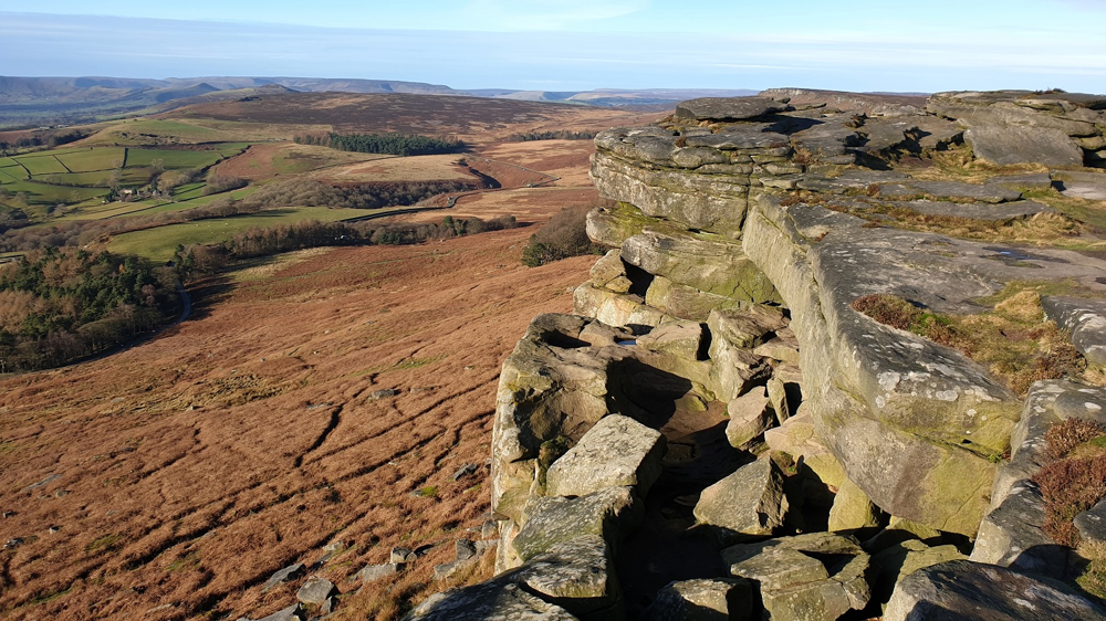
View from Stanage Edge across the moors of the Dark Peak. The Stanage bridleway is a rocky old packhorse route paved with gritstone slabs at the top, leading into a boulder-strewn descent.
Mam Tor & Castleton Loop (Dark Peak/White Peak border, Derbyshire)
Overview: Mam Tor, known as the “Shivering Mountain,” guards the entrance to the Hope Valley above Castleton. While a popular hiking peak, it also offers a short but epic mountain bike loop for experienced riders. This typically involves a steep climb (often on the broken remains of the old Mam Tor road or a bridleway) and a fast, fun descent either down the shattered tarmac or via nearby bridleways. The routes here are shorter than the big Dark Peak epics, making it a great half-day ride with plenty of excitement and scenery. It’s an excellent option if you’re based in Castleton or want to tag on an extra ride after doing a bigger loop. Mam Tor is also a favouriate with the local paragliders, although I am yet to fly it myself.
Technical Difficulty: Moderate/Advanced. We’d grade it Red overall. The main challenge is the climb (steep and lung-busting) and the descent which, while “fast and flowing”, has technical features like loose rocks and drop-offs. Compared to Jacob’s Ladder or Stanage, Mam Tor’s descents are a bit more forgiving, but still require solid skills (especially at speed).
Terrain: The infamous Broken Road – the abandoned old A625 road that was destroyed by landslides – provides a unique riding surface. It’s like a giant asphalt puzzle: huge slabs of broken tarmac at crazy angles. Riding down it is surreal and bumpy, but not overly technical (just mind the sudden steep sections where the road has collapsed!). Aside from that, there are gravel and grass bridleways. One common route is: climb from Castleton up the Broken Road (or the steep bridleway parallel to Winnats Pass), then descend via Cave Dale into Castleton. Cave Dale is a limestone dry valley/bridleway that starts with a very rocky, loose limestone section – it’s technical (likely Black grade for a short bit) with rubble and bedrock steps. Once past the initial gorge, it smooths out to a grassy track. Alternatively, some riders go up the Mam Nick road and then take the ridge bridleway from Hollins Cross down into Castleton (this descent is also rocky at the top then turns into a fast grass track). In summary: expect loose stone, some broken pavement, and limestone bedrock. Little to no mud, as this area drains well.
Suitability (e-MTB/Hybrid): E-MTB: Yes, it helps immensely on the steep ascents (you might actually ride what others push!). On the descent, just be careful on the loose rocks. Hybrid: Partially. If you stick to the broken road up-and-down, a sturdy hybrid could handle the lower part of the broken road and the connecting smooth bits, but it will be very shaky on the uneven tarmac chunks. Cave Dale is not hybrid-suitable at all (sharp rocks). So hybrids are not recommended for the full loop. However, a hybrid rider could do a road climb (Mam Nick paved road) and then possibly descend the gentler bridleway from Hollins Cross to the valley on the east side, but even that has some rocky sections. In short, this route is best enjoyed on a mountain bike.
Route Length: Roughly 5 to 8 miles (8–13 km) depending on start/finish, so quite short. The Mam Tor loop often described (~5 miles) can be done in 1–2 hours, but allow extra time to explore or repeat a fun descent. You might combine it with nearby trails (for instance, from Castleton you can also ride up to Hollins Cross or do a side trip up Winnats Pass road if you’re masochistic).
Bike Hire: Castleton village doesn’t have a bike hire shop, but it does have outdoors shops and guiding companies. If you plan ahead. Castleton is a tourist hub (for caverns, etc.), so accommodation owners might sometimes have links to bike hire as well.
Public Transport: Bus from Manchester – on weekends and summer days, the X57 bus (Snake X57) goes from Manchester to Sheffield via the Peak District, stopping in Castleton. Alternatively, take the train to Hope (from Manchester, 50 min) and then a local bus 271/272 or cycle 2 miles to Castleton. Once in Castleton, everything is accessible by bike. The Broken Road starts just outside the village by Mam Farm. If ending your ride at the top of Mam Tor, note there is a bus (272) from Mam Nick back to Castleton/Sheffield, but usually you’ll just roll back down to the village.
Local Highlights: Mam Tor is an ancient hill – literally, it’s an Iron Age hill-fort (you can see remnants of ramparts on the summit). Its name means “Mother Hill” because frequent landslides create numerous “baby” hills below it. Those same landslides famously wrecked the old road in the 1970s; as you ride the Broken Road you’re essentially biking through a piece of British engineering history succumbing to nature. The collapsed road and exposed clay layers are a dramatic sight. The views from Mam Tor’s summit (517 m) are spectacular – you see the Edale Great Ridge extending east (Lose Hill, back towards Hope) and the patchwork fields of the White Peak to the south. Castleton below is known for its show caverns and the semi-precious Blue John stone mined locally. If you descended Cave Dale, you rode right under the shadow of Peveril Castle, a Norman castle ruin perched above the dale – an atmospheric touch to a thrilling descent. The valley here marks the transition from the Dark Peak (gritstone, coarse grass on Mam Tor’s north face) to the White Peak (limestone – you’ll notice Cave Dale’s white rocks). After the ride, Castleton offers plenty of pubs and cafes. Don’t miss a slice of Bakewell pudding or a hearty pie to refuel.
Black Harry Trails – Longstone Edge (White Peak, Derbyshire)
Overview: The Black Harry Trails are a network of linked routes (approx. 10 trails covering ~20 km) in the Longstone Edge area, near Bakewell. They are unique in the Peak District in that they were developed as a network specifically welcoming to mountain bikers (and horse riders) on existing rights of way, complete with signposts and a leaflet map. For an expert rider, these trails provide a different flavor from the Dark Peak: expect limestone tracks, old mine routes, and some smoother surfaces, with plenty of short, steep climbs and drops. It’s an ideal area for a mixed group of skills – you can ride hard and fast, but less aggressive riders or even hardy hybrid cyclists (on select trails) can also enjoy the network. The trails can be combined into various loops.
Technical Difficulty: Moderate to Advanced. Individually, most Black Harry route segments are moderate (Blue to Red grade). However, linking them into a long loop with sustained effort can make it feel harder. There are a few short steep sections that advanced riders will relish (loose rocky climbs/descents). Overall it’s less technical than the rocky Dark Peak classics – think of it as an approachable XC trail network with a couple of spicy bits. Great for a fast-paced ride with technical interest.
Terrain: Predominantly limestone and dirt trails. You’ll encounter loose gravel, limestone bedrock, hard-packed earth, and the odd muddy patch in woods. Some segments are on old mine access tracks and packhorse routes, so the surface might be broken stone. Gradients can be steep and some surfaces loose – for example, climbing out of Coombs Dale is a lung-burner on loose gravel. One noteworthy section is the Coombs Dale concession bridleway – its lower part is actually surfaced and nearly flat (even wheelchair-suitable), which is the easiest section. Elsewhere in the network, you have trails like Black Harry Lane (a classic bridleway) and routes across Longstone Moor – these have a mix of grass and stone and can be rutted. There are also woodland singletracks near Great Longstone village that thread through the trees. Navigation is eased by trail signage (look for the Black Harry logo on posts). As for tarmac: minimal, apart from brief country lane crossings.
Suitability (e-MTB/Hybrid): E-MTBs will find these trails enjoyable and not overly taxing on battery (the network isn’t huge). The ups and downs are perfect for e-bike, though an analog bike is fine too given many climbs are short. Hybrids: Yes, to an extent – this is one of the few recommended areas for a sturdy hybrid. Several Black Harry routes were designed with multiple user types in mind. The easy Coombs Dale lower trail is almost rail-trail smooth (suitable for hybrids or even touring bikes). Some of the higher routes are rougher, so a hybrid might need to dismount on rocky bits, but overall a hybrid with off-road tyres could manage a decent loop here with minimal tarmac, sticking to the gentler bridleways. The signage actually helps one choose easier vs harder loops. So, if someone in your group has a hybrid, this area is a good choice compared to the very rocky Dark Peak trails.
Route Length: The entire network totals about 20 km of trails, which you can ride as one big figure-eight loop (20–25 km). That would be a half-day ride (2–4 hours depending on pace). Of course, you can do a shorter 5–10 km loop for a quick hit, or extend into a full day by riding into nearby areas (e.g. linking to the Monsal Trail or Eyam). As an expert rider, you might blitz through all the segments fairly quickly, but take time to enjoy the scenery and maybe session a fun section twice.
Bike Hire: Hassop Station (on the Monsal Trail, 3 miles from Black Harry area) has a bike hire centre. They primarily rent leisure bikes (hybrids, ebikes, a few mountain bikes) for the rail-trail, but those could be used to explore the easier Black Harry routes too. Serious riders should look to bring their own bikes or hire from shops in Sheffield/Derby. Near Bakewell, there’s also Blackwell Mill Bike Hire at the other end of Monsal Trail (farther) – not very convenient for Longstone Edge specifically. In short, rental options are a bit limited directly in Bakewell for high-end MTBs, but the Hassop hire can cover basic needs.
Public Transport: Take a train from Manchester to Sheffield (~50 min), then bus 218 or 257 from Sheffield to Bakewell (about 1 hour). From Bakewell, Longstone Edge is ~3 miles – you can cycle via the Monsal Trail (flat path) to Great Longstone, which is a nice warm-up. Alternatively, train to Chesterfield then bus to Bakewell, or train to Buxton then bus (less direct). Once at Bakewell or Great Longstone, the Black Harry trails are accessible from the village of Stoney Middleton, Calver or Bakewell – the leaflet map (available online peakdistrict.gov.uk) shows multiple start points. Tip: If you don’t mind a hilly ride, you could actually take the train to Matlock and then cycle ~8 miles into the Longstone area via Rowsley.
Local Highlights: Why “Black Harry”? The trails are named after an 18th-century highwayman, Black Harry, who ambushed travellers crossing Longstone Moor. He was eventually caught and executed – supposedly gibbeted at Wardlow Mires, where vultures picked his bones! Today, fortunately, the only ambush might be a surprise sheep on the trail.
The landscape here is in the White Peak: you’ll notice lighter-colored rocks, lush dale valleys, and evidence of old mining. Longstone Edge has seen extensive lead mining and fluorspar mining – you might pass fenced-off mine shafts or see the remains of quarries. In fact, a lot of the trails owe their existence to those old mine routes. The area also partakes in local traditions – the villages of Great Longstone and Stoney Middleton are known for their well dressings (floral displays) and you might stumble upon charming hamlets. One picturesque spot on the network is Coombs Dale, a beautiful limestone valley that is also a nature reserve (keep an eye out for wildflowers and maybe peregrine falcons on the cliffs). From the high points on Longstone Moor, you get views towards Chatsworth House estate to the east and back towards Mam Tor to the west. The riding is a great mix of nature and heritage: one minute you’re rolling past an old gate labeled “Black Harry Gate”, the next you’re zipping through woods on a smooth singletrack. It’s a lesser-known gem in the Peak District’s MTB scene, offering a mellower but still rewarding experience.
Trail Centres and Man-Made Trails
While the Peak District National Park itself doesn’t have purpose-built trail centre loops (the riding is mostly “natural” trails), there are a few man-made trail areas on the outskirts that are worth a visit. These spots feature constructed singletracks, berms, jumps, and freeride elements similar to classic trail centres. They can be great for a change of pace or a quick skills session. We highlight two of the nearest and best: one to the east near Sheffield and another on the north edge of Sheffield. Both are easily reachable and complement the Peak’s natural trails.
Lady Canning’s Plantation (Peak District Fringe – Sheffield)
Trail Centre Type: Flowy singletrack loops (Blue grade). Lady Canning’s is a compact trail centre experience set in a wooded plantation on the edge of the Peak District, just outside Sheffield’s city limits. It features two main purpose-built trails: “Blue Steel” and “Cooking on Gas” – both are blue-grade flow trails. Don’t let the Blue grade deter you if you’re an expert: they’re incredibly fun, fast if you push, and perfect for honing cornering skills. This site provides a quick thrill and is popular for night rides and post-work laps for Sheffield riders.
Technical Difficulty: Easy/Intermediate (Blue). It’s designed to be “never intimidating and without any scary features” mbr.co.uk. An expert rider will find it straightforward but can still enjoy pumping the rollers and railing the turns at high speed. There are no big drops or rocks – it’s all about smooth flow.
Terrain: Machine-built singletrack through pine forest. Expect a hard-packed dirt surface with gentle berms, rollers, whoops, and the odd mild tabletop jump. The trails undulate but there are no huge climbs or descents – it’s a gentle gradient overall, meaning you might need to pedal in sections to maintain speed. “Cooking on Gas,” the newer trail, is a “twisty rollercoaster” that winds among the trees. Blue Steel (the older trail) was recently updated; it similarly offers flowy, rhythmic riding with safe, natural-feeling bumps that “encourage, rather than take away, speed” mbr.co.uk. In short: smooth, banked turns, no rocks, minimal roots, and a well-drained surface (rideable year-round). Each loop is about 1.5 to 2 miles (3 km), and they share an easy climbing trail to the top.
Suitability (e-MTB/Hybrid): E-MTBs: Yes, though not necessary given the trails are not steep. An e-MTB might actually feel overpowered here, but you’ll have fun doing multiple laps effortlessly. Hybrids: Borderline. The trails are non-technical, but a true hybrid bike (with skinny tyres and rigid frame) would struggle with the berms and loose dirt at speed. If it’s all you have, you could carefully ride Blue Steel (some people do on cyclocross bikes), but you won’t get the full experience. Better to use a front-suspension MTB at least. There is no tarmac on the loop aside from the trailhead parking area.
Length & Ride Time: Each trail is short – a loop of both might be ~6 km. Doing both trails plus repeats can make for an hour or two of riding. Many bikers do multiple laps to pack in the fun. As an expert, you might treat this as a quick session (e.g., do 3–4 laps in an afternoon). It’s not a full-day venue by itself, but it pairs well with a ride on nearby natural trails (e.g., you could ride up from Sheffield, do laps at Canning’s, then continue onto the moors).
Facilities & Bike Hire: There is a small car park at the trailhead (cutting/Norfolk Arms pub area) but no visitor centre/café – this is a relatively “minimal” trail centre (just trails in a forest). Bring what you need. Sheffield city is 15 minutes away for food and bike shops. No on-site hire, so arrange in Sheffield if needed. Go Outdoors Sheffield store isn’t far and sometimes arranges demo days here. If you’re staying in the Hope Valley, Lady Canning’s is a 30-minute drive or 1 hour ride away.
Public Transport (from Manchester): Take the train to Sheffield (~50 min). From Sheffield station, you can ride about 6 miles (mostly uphill) to Lady Canning’s – head out through Ecclesall and Ringinglow. There are also buses within Sheffield (e.g. the 272 heading towards Castleton will get you up Ecclesall Road South; alight near Ringinglow and pedal 1 mile). If you’re ambitious, you can actually ride from Hathersage/Hope up over Stanage Edge and drop down to Lady Canning’s – it’s part of some big rides, but that’s a huge day out.
Local Notes: Lady Canning’s Plantation is within the Peak District boundary (technically the eastern fringe) and is on Sheffield City Council land. It was one of the first crowdfunded MTB trail projects, driven by the local advocacy group Ride Sheffield. The result is a shining example of how a city can integrate outdoor activities – Sheffield proudly calls itself “the Outdoor City.” The plantation itself is named after Lady Polly Canning (wife of a short-lived Prime Minister in 1827) geograph.org.uk. It’s a pleasant pine wood with heather moorland adjoining it (you get a nice scent of pines as you ride). Look out for fellow riders of all ages – you’ll see everyone from kids on hardtails to experts doing laps on enduro bikes. For an expert rider, Lady Canning’s is pure fun: a chance to let off the brakes and carve corners with no surprises. It might remind you why flow trails are so addictive. After your ride, consider popping into the Norfolk Arms at Ringinglow for a pint – it’s a pub just down the road that often hosts muddy riders.
Grenoside Woods (Northern Edge of Sheffield)
Trail Centre Type: Downhill/Freeride trails (Red/Black). Grenoside (or “Greno”) Woods is a renowned MTB spot on Sheffield’s north side. This woodland has three dedicated, well-maintained downhill trails, created and maintained with the help of the annual Steel City Downhill race (spearheaded by local legend Steve Peat). Unlike Lady Canning’s, Greno’s trails are steeper, faster, and aimed more at gravity riders – though you still pedal up via a fire road loop to session them. Think of Greno as a mini bike park: berms, jumps, drops, and technical features under the canopy of an oak and pine forest.
Technical Difficulty: Intermediate to Expert (Red and one Black line). The trails are short but pack a punch: “Pub Run” (a popular red) has jumps and rock features; “Steel City DH” (red) is built for racing with big berms and whoops; and another line (often called DH3, now revamped) pushes into Black territory with larger gap jumps and technical sections . Good riders will find a flow; less experienced may find it challenging, especially at speed or if tackling the biggest jumps.
Terrain: Purpose-built downhill singletracks. Expect packed dirt and sand (Greno’s soil drains well, but can get loose in summer or muddy in winter). There are plenty of bermed corners, tabletop jumps, smaller gap jumps, rock gardens, drop-offs, and log features. Notably, Pub Run trail is described as “nice flowing DH single track … with plenty of features including berms, tables and rock gardens and one small gap jump” trailforks.com. The Steel City track is flowy but can get quite rough at race speeds – lots of whoops to pump. There is a newer black-grade section (some locals call it “DH3”) which includes bigger jumps – however, all major features have ride-arounds if you’re not up for airtime. The elevation drop is modest (~50 m), so runs are short and sweet, around 1–2 minutes each. Push or spin up via the main bridleway climb (not long). You’ll likely do multiple laps to get your thrills. Surfaces are entirely off-road; no tarmac except the parking area.
Suitability (e-MTB/Hybrid): E-MTB: Great for quickly getting back up to the top for another run! Just note the jumps – the weight of an e-MTB might make catching air a bit different, but many e-riders shred here. Hybrids: Absolutely not. These are downhill mountain bike trails with drops and jumps – totally inappropriate for a hybrid. Even the climbing track is a rocky bridleway; a hybrid would rattle. If someone with a hybrid comes, they could stick to the Trans Pennine Trail which runs nearby on an old rail bed – but that’s separate and not the MTB trails.
Length & Ride Time: Each trail ~0.5 miles long. Typically riders spend 1–3 hours here doing repeated runs. It’s a session spot rather than a single long ride. It could be part of a day’s itinerary (for example, some bikepackers do a loop hitting Wharncliffe Woods (another MTB spot nearby) and Greno together).
Facilities & Bike Hire: Parking at Grenoside Woods (at the end of Woodhead Road) is free. There’s no official trail centre building. However, on race days or weekends you might find coffee or food vans occasionally. Bring supplies. For bike hire, none on-site. The nearest city is Sheffield’s northern suburbs – there’s Langsett Cycles not far (this shop was actually Steve Peat’s old team sponsorwelcometosheffield.co.uk). They might demo bikes. Otherwise, bring your own or rent in Sheffield. Greno is also an open public wood, so walkers and horse riders might be about on the main paths (not usually on the DH tracks though).
Public Transport: Take a train to Sheffield. From Sheffield centre, Greno Woods is ~7 miles north. A taxi with bike might be easiest (~20 minutes). By bus: the Stagecoach 86 to Grenoside village, then pedal 1 mile. Or train to Chapeltown (from Sheffield, 15 min) which is ~2 miles from Greno – you can cycle from Chapeltown station fairly easily. Coming from Manchester, if you have a car, it’s about 1 hour drive via the A628.
Local Notes: Grenoside Woods almost fell out of public hands in 2011, but a campaign (boosted by the MTB community and Peaty’s Steel City Downhill fundraiser) helped Sheffield Wildlife Trust purchase it. All profits from the yearly Steel City DH race go back into maintaining and building trails. This community-driven ethos means the trails are well-loved and regularly maintained by volunteers and Ride Sheffield. For expert riders, Greno is a playground: you can practice drops and jumps, or even race the clock unofficially. In spring, the Steel City race (dubbed “the biggest little race”) draws big crowds – imagine cheering spectators lining the track through the trees. Steve Peat himself often rides here (it’s basically in his backyardwelcometosheffield.co.uk). The vibe is friendly and progressive – don’t hesitate to chat with local riders for line tips. Also, Greno connects to Wharncliffe Woods a few miles away (another famous MTB locale with more gnarly, unofficial trails – where Peaty honed his skills). If you fancy, you can ride a bridleway over to Wharncliffe and sample trails like “Deer Track” or “Fast Track” there – though those are not signposted, local knowledge required. Finally, when you’re done, the Red Lion pub in Grenoside isn’t far for some hearty Yorkshire refreshment. Grenoside shows that you can get a downhill fix right next to the Peak District without needing a full alpine bike park – it’s raw, fun, and part of the fabric of Sheffield’s MTB culture.
Mountain Biking in Macclesfield Forest
Macclesfield Forest is my home turf having grown up on the hill behind it. Its situated on the western edge of the Peak District, offers a diverse range of mountain biking trails suitable for various skill levels. The forest’s terrain includes ancient woodlands, conifer plantations, and open moorlands, providing riders with a mix of natural and man-made trails. The area is known for its challenging climbs, technical descents, and scenic vistas, making it a popular destination for mountain biking enthusiasts.
Trail Highlights
Charity Lane: A renowned descent featuring rocky terrain and technical sections, suitable for experienced riders. A tricky
Trail Highlights
Macclesfield Forest offers a selection of trails that suit both intermediate and advanced riders, each with its own character and technical features. Charity Lane is one of the most well-known descents in the area, marked by rocky terrain and technical challenges that make it a favourite among experienced riders. Macc Forest DH Main Line is a dedicated downhill route with steep gradients and technical obstacles, best suited to advanced riders with solid handling skills.
For those after something a little less intense, the Forest Bridleway provides a versatile ride across a mix of surfaces, making it ideal for mountain bikes and e-MTBs. Oven Lane delivers a moderately challenging ride through varied terrain, while Cumberland Clough offers a scenic mix of climbing and descending through wooded areas and open sections – a great option for riders seeking a solid mid-level challenge. Across the forest, riders will find a blend of natural features like roots and rocks, as well as some smoother, flowing singletrack sections.
Trail Surfaces
The terrain in Macclesfield Forest is diverse, contributing to the variety and technical challenge of its trails. Natural surfaces dominate, with root-covered paths, rocky outcrops, and sections of loamy soil that require focus and good bike control. There are also man-made features scattered throughout, such as berms, jumps, and the occasional boardwalk, especially on more popular downhill lines.
Linking these trails are gravel and fire roads, which provide less technical riding and are ideal for warming up or connecting routes. This mix means riders need to be comfortable adjusting to rapidly changing trail conditions and should be confident in their technical skills.
E-MTB and Hybrid Bike Suitability
Macclesfield Forest is very well-suited to e-MTBs, especially given the steep ascents and demanding descents. Riders on electric bikes will benefit from power assist when tackling climbs like those leading up to Charity Lane or the DH Main Line, while still enjoying the descending flow and challenges of the trails.
Hybrid bikes, on the other hand, are only suited to selected routes in the forest. They can comfortably manage gravel paths and fire roads, making it possible to explore some parts of the area, but they are not built to handle the rocky, rooty or technical sections of the main trails. Riders using hybrids should stick to the easier bridleways and ensure their tyres and brakes are up to the task.
Bike Hire
Bollington E-Bikes: Located in Bollington, they offer a range of electric bikes suitable for exploring the surrounding areas. It’s advisable to contact these centres in advance to confirm bike availability and suitability for the intended trails.
Transport Links from Manchester
Macclesfield is accessible via train from Manchester, with services running regularly. Upon arrival at Macclesfield Station, riders can cycle to the forest through Sutton and Langley, which is approximately 6 miles away, or arrange for local transport. Alternatively, driving from Manchester to Macclesfield Forest takes about an hour, depending on traffic conditions.
Accommodation Options
For riders planning to stay overnight:
- Camping: There are campsites available in the vicinity of Macclesfield Forest, offering a rustic experience close to the trails.
- Local Inns and B&Bs: The nearby towns and villages provide various accommodation options, ranging from traditional inns to bed and breakfasts, catering to different preferences and budgets.
Historical and Landscape Features
Macclesfield Forest has a rich history, having been part of the Royal Forest of Macclesfield, a medieval hunting reserve. The landscape is characterized by its diverse woodlands, open moorlands, and the presence of reservoirs like Ridgegate and Trentabank, which support local wildlife and contribute to the area’s natural beauty.
Accommodation Options for Riders
After long days on the trails, you’ll want a comfortable (and bike-friendly) place to rest. The Peak District has plenty of accommodations, from campgrounds to inns and hostels. Here are a few practical options popular with mountain bikers:
- YHA Castleton Losehill Hall (Hope Valley): A top choice for cyclists. This youth hostel (in a grand old manor) just outside Castleton has secure bike storage, a drying room for wet gear, and self-catering facilities. It’s centrally located for Mam Tor, Hope Valley, and even Ladybower (short drive/ride). They offer private rooms and dorms, and being a hostel, they’re used to muddy boots and bikes. The large grounds and on-site bar/café are a bonus. From here you can ride directly to trails like Cave Dale or Edale.
- Ladybower Inn (Bamford/Derwent): A traditional pub with rooms right on the shores of Ladybower Reservoir. It has only a handful of rooms but all are en-suite and dog-friendly ladybowerinn.com. Importantly for bikers, they have free parking and you can often arrange to keep bikes in a safe area (check with the inn). You’re literally across the road from the Ladybower Loop trail. After a ride, enjoy hearty pub grub and local ale downstairs. The views over the water are fantastic. (Another similar pub option: Yorkshire Bridge Inn, also in Bamford – equally welcoming to outdoorsy folk.)
- Edale Campsite & Pubs (Edale): If you prefer camping under the stars, Fieldhead Campsite (sometimes called Edale Village Campsite) in Edale is a solid choice. It’s right in the village near the Nag’s Head pub (the Pennine Way start). Basic facilities but a beautiful location and you can ride out to Jacob’s Ladder from your tent. There’s also Cooper’s Farm campsite in Edale which is biker-friendly. For a bit more comfort, Edale has The Rambler Inn, a pub with rooms, which often hosts hikers/bikers – they have a drying room and allow bike storage (usually in a lockable outbuilding). Edale’s advantage is you can start some epic rides right from your door.
- Sheffield – City Accommodation: If you plan to focus on the trail centres (Lady Canning’s, Greno) or want nightlife, staying in Sheffield is an option. Many city hotels will let you keep a bike in your room or have secure storage (always inquire). The Harley Hotel or Premier Inn Sheffield City Centre are used to guests with outdoor gear (Sheffield being the “Outdoor City”). You can then drive or ride to the trailheads. Not as scenic, but convenient for a multi-purpose trip.
- B&Bs and Holiday Cottages: Throughout the Peak there are small B&Bs and rental cottages. Look for ones advertising to cyclists – for example, Losehill House Hotel & Spa (more upmarket, in Hope) offers bike storage and even recovery massages! Candle House in Castleton (a self-catering holiday home) is noted for being bike-friendly (secure garage for bikes, wash-down area). If traveling with a group, a cottage in Hope or Hathersage can be a great base – just ensure they have space for bikes.
When booking accommodation, it’s wise to confirm they can securely store bicycles (or at least allow them in rooms). Most places in this region are accommodating if asked, as cycle tourism is common. Another tip: many pubs in the Peaks double as informal biker hangouts – e.g., the Old Hall Hotel in Hope welcomes cyclists for meals and has an outdoor seating where you can keep an eye on your bike.
Final Tips: The Peak District’s mix of natural and man-made trails offers something for every expert rider – from all-day epics across wild moors to quick adrenalin hits in the woods. Always ride prepared: weather can change quickly on the high ground (carry a jacket and tools), and some areas have patchy phone signal. Trails here are often multi-use, so be courteous to walkers and horse riders – a friendly “hello” goes a long way on a narrow bridleway. Lastly, give yourself time to soak in the surroundings. Whether you’re catching sunset on Stanage Edge or freewheeling past a packhorse bridge in a quiet dale, the Peak District’s landscape is what makes these rides truly special. Enjoy the ride, and then enjoy a well-earned pint and a pork pie – you’ve earned it.
Sources: The trail details and difficulties are drawn from my personal experience as a MTB enthusiast born and raised in the Peaks (in Macc if you must know). We also reference great guides and MTB magazines museescapes.com, mountainbikerides.co.uk, mbr.co.uk, as well as the Peak District National Park’s own descriptions for routes like Black Harry peakdistrict.gov.uk. All information is up-to-date as of 2025, but always check current trail conditions and any access updates (Peak District MTB group’s website is a good resource).
On adventuro we the best MTB coaches and guiding around the Peak District, book on below.
- Private MTB Skills Coaching in Sheffield and the Peak District
- Mountain Bike Guiding & Coaching in the Peak District
- Junior (>11yrs) MTB Jumping & Flow Course in Sheffield & the Peak District
- Junior (>11yrs) MTB Descending & Race Skills – Sheffield & Peak District
- MTB Enduro Race Skills Course in Sheffield & the Peak District
Happy trails!